Alliance Members

Back Bay Watershed Association
Eel River Watershed Association
Herring Ponds Watershed Association
Jones River Watershed Association
Neponset River Watershed Association
North and South Rivers Watershed Association
Pembroke Watershed Association
Save the Bay: Narragansett Bay
Six Ponds Improvement Association
Taunton River Watershed Association
Weir River Watershed Association
Westport River Watershed Alliance

Saturday, December 21, 2013

A Snowy Owl Update, from Mass Audubon


Reblogged from the Neponset River Watershed Association blog, first posted from a Mass Audubon blog

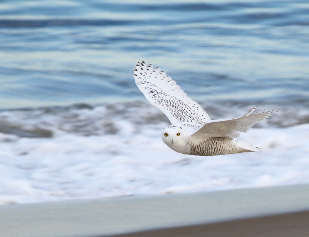
Currently New England is hosting a major incursion of snowy owls, many of which will likely spend the winter in our area.
Snowy Owl copyright David Larson
Photo © Dave Larson
Typically these Arctic visitors tend to appear most frequently near the coast, but the first report this year was inland at Mount Wachusett in Princeton on November 17. Since then, snowy owls have been showing up all over Massachusetts. See a map of recent sightings on eBird.

Why So Many Snowy Owls?
The snowy owl is considered an “irruptive” species—one that responds to changes in the conditions on its home territory by moving elsewhere in search of food.  Some of the factors that may trigger these irruptions include variations in food supply in the Arctic, severe snow and ice cover in their usual wintering areas, or a superabundance of owls resulting from an exceptional nesting season prior to a southward irruption.
For many years it was assumed that snowy owl irruptions only occurred in years when the lemmings that comprise the snowy owls’ primary food in the Arctic were in short supply, thus forcing the starving owls to move south in search of food.
However, Norman Smith, sanctuary director of Blue Hills Trailside Museum and lead of Mass Audubon’s Snowy Owl Project says “We actually see the most snowy owls in New England after an Arctic lemming population boom, not bust.” High lemming populations improve breeding success, and irruptions typically consist mostly of hatch-year birds (ones born this year).

Where to See Snowy Owls
Snowy owls arriving in Massachusetts tend to seek local habitats that mimic the Arctic tundra where they spend most of their lives, such as large salt marshes, extensive agricultural fields, and even airports. Popular sightings include Westport, New Bedford, Nantucket, Orleans, Duxbury Beach, and of course, Plum Island.
Accordingly, if you are passing a large open field this winter, that white spot in the distance might only be an errant piece of plastic, but it could also be a snowy owl!
Reposted from a Mass Audubon blog, posted December 7, 2013 by Hillary. Text by Marj Rine, Photo © Dave Larson


This post is from the Neponset River Watershed Association’s Neponset Nature Blog. The original post can be found at: http://www.neponset.org/happenings/neponset-nature-blog/snowy-owl-update/

Tuesday, December 10, 2013

Did You Know? Clean, Plentiful and Free Flowing Water in 2013 Thanks to Watershed Associations

by Dorie Stolley, Watershed Action Alliance Coordinator and Outreach Manager

With Thanksgiving recently passed and the New Year on its way, it’s a good time to look back over the year and the accomplishments of watershed associations in southeastern Massachusetts, which work for clean, plentiful and free flowing water for both wildlife and people.

Clean Water. This year scores of watershed volunteers across the region participated in cleanup efforts, removing debris that can strangle streams, plastic that can poison fish and people, and old traps and other items that can mutilate or kill wildlife. For example, one hundred shopping carts, 12 bicycles, toilets and tires were hauled out of the choked Neponset River during one day in August. Plastic drink bottles by the hundreds, several lobster traps and innumerable pieces of Styrofoam were gleaned from the mouth of the Eel River in November.  The Butt Brigade was launched in Narragansett Bay to gather data about discarded cigarette butts, which will be used to target solutions for this insidious littering problem.

Volunteers haul a shopping cart out of the Neponset River in August.
Other things that foul our water are less visible. Common pollutants include pesticides, bacteria, and nutrients such as nitrogen and phosphorus, which, in excess, can over fertilize water causing rampant algae and plant growth. The algae can clog waterways, choke out useful plants and even lower oxygen levels causing fish kills.  The biggest nutrient problems come from wastewater treatment plants, leaky sewage systems, and untreated polluted runoff from roads and yards during storms, which also can provide a lot of bacteria. To combat these evils, in 2013 watershed associations worked on a host of projects including installing rain gardens, pushing for better regulations for wastewater treatment plants and proposing less costly alternative to updating septic systems.

Rain gardens not only remove nutrients from runoff, they filter out other pollutants and sediment, which makes them cost effective in the fight to prevent tainted water from entering our streams. A rain garden is strategically placed in a depression near a runoff source, like a road that channels water or the edge of a parking lot. It is planted with deep-rooted native plants, which also beautify the landscape, and must be maintained periodically for best performance.

Westport, MA is enjoying numerous new rain gardens and avoiding the costs of more expensive rainwater runoff treatment techniques because of a partnership between the Westport River Watershed Alliance, the Town of Westport and the Buzzard’s Bay National Estuaries Program. Volunteers contribute to this work, too: for instance, they planted over 500 plants in the rain gardens at the Westport Middle School.

Other ways that watershed associations in southeastern Massachusetts worked to achieve cleaner water included identifying areas where nonpoint source pollution was worst and working with towns to install structural filters, recommending practices for protecting groundwater and Cape Cod Bay for the Plymouth Nuclear Power Plant, and educating residents on how to keep pollutants out of the water, for instance, by cleaning up pet waste and using minimal amount of fertilizer (or none) on lawns.

New sign in Scituate reminding watershed
residents to conserve  water.
Plentiful Water. Not only did watershed associations work to keep water clean, they worked to keep it plentiful. Plentiful water in streams and rivers is necessary for river herring to travel upstream to spawn in the spring. In the summer and fall, the outmigration of young herring from their hatching grounds in freshwater to the ocean where they spend much of each year is dependent on adequate water as well. To this end, in 2013, summer residential water restrictions on alternate days put in place by North and South Rivers Watershed Association once again saved 30,000 gallons per day on First Herring Brook in Scituate. A new sign reminding residents to conserve water during summer months and thanking them for their efforts during times of adequate streamflow was installed along a major travel route.

2013 saw a giant step forward in the decades-long effort to restore adequate streamflow to the Jones River in Kingston. Silver Lake is the headwaters of the Jones, however, the City of Brockton withdraws so much water from it that the stream has not flowed normally for decades to the great detriment of wildlife, particularly aquatic species such as river herring. This year, as part of the Sustainable Water Management Initiative, a grant allowed for a report on water use operations of Silver Lake and the nearby Monponsett Ponds. Its conclusions were that the present use is not sustainable and is detrimentally impacting the ecological health of the river, meaning that more water is needed to flow in the Jones. The completion of this report is an important step in returning enough water to the Jones for fish to flourish and the ecosystem as a whole to thrive.
 
Plantings on the restored stream bank by the former
Whittenton dam in the Taunton watershed.
Free Flowing Water. This year saw much headway on projects to remove outdated dams that block the flow of water, form obstructions to river herring and other migratory fish and trap stagnant water. For instance, in the Taunton watershed, after 170 years in place, the Whittenton dam came down and its waters were released back into the original channel. Within weeks, a crew rebuilt its stream banks and replanted the wetlands. It is the second of three dams along the Mill River to be removed. Once the third is gone, an unprecedented 30 miles of habitat will be opened up to migratory fish like river herring and American Eel. Other benefits of this project are the elimination of the risk of catastrophic flooding from a breach of the dam and new recreational opportunities for residents.


This is just a smattering of all of the work done by watershed associations in 2013. The member organizations of Watershed Action Alliance work for you to protect water resources and the wildlife that depends upon them and to provide opportunities for water recreation. Join your association to support their work. To find your watershed association, visit http://watershedaction.org.

Friday, December 6, 2013

Looking Back: My Time with WAA

Today’s Blogger is Shalen!


Me kayaking down the North River
Wow, I marvel at how this year raced by: I can’t believe it’s December! December for me means frantically preparing for the semester’s finals, and it’s also a time for reflection on my accomplishments and experiences of the year. These past six months with WAA have been amazing, life changing ones, during which I learned an incredible amount about climate change, watershed recreation, dam restoration, marsh restoration, rain gardens, and much more. Most importantly, I met many of the incredible individuals who dedicate themselves to their organizations. I’ve visited seven watersheds (Neponset River, Jones River, North and South Rivers, Herring Ponds, Westport River, Back River, and Narragansett Bay) and their acompanying associations. Before beginning my time with WAA, I honestly did not know much about southeastern Massachusetts, other than about the famed Plimoth Plantation and Plymouth Rock.
Dorie and me at the Pawtuxet River, Narragansett Bay watershed
            I’m from Woburn on the North Shore of Massachusetts, and spend most of my time north of Boston, apart from my semesters at Stonehill College. To have the opportunity to spend so much time learning about and traveling to the southeastern Massachusetts watersheds has been an enriching and unique experience, to say the least. I’ve had completely new and fun experiences that I never otherwise would have had: I kayaked for the first time in the 2013 Wampanoag Paddle with the North and South Rivers Watershed Association, cruised down the Back River for a boating event organized by State Representative Murphy, and canoed part of the Jones River in Kingston. Working with Dorie, the WAA coordinator and outreach manager, and all of WAA’s amazing allies and members has only strengthened and reaffirmed my commitment to the environment, to sustinable living, and to fighting to make this world a safe and healthy one in which future generations of all beings can flourish. To learn more about each of these watershed associations, please visit WAA’s website here: http://watershedaction.org/.
Some of my most memorable trips were ones in which I saw children engaged and excited in learning about their local environments. Children are curious and inquisitive, and instilling in them a respect and love for the environment at an early age is crucial. The Westport River Watershed Alliance and Save the Bay—Narragansett Bay are two of the organizations that have classrooms in their headquarters. However, outreach and  education are very important to all of WAA’s member organizations, and many take their programs into the schools or out on the rivers!
Me at the 2013 Wampanoag Paddle, thanks to NSRWA
As a senior English major, I’m badgered about my plans after college, and many of my family members assume that since I’m an English major, I must want to teach. Until now, I thought teaching was out of the question (I’m not cut out for a career in a traditional education system), however, now I could see myself teaching in a different way. Would I be willing to share my experiences to encourage and educate others to get involved in saving our local ecosystems as well as the biosphere as a whole? Absolutely.Visiting Save the Bay at Narragansett Bay, and seeing their interactive labs, classrooms, and education vessels invigorated me in a way I was not expecting in this regard.
            I never imagined I would be able to help WAA and its member associations as much as I have in the past six months. I’m proud of my accomplishments and even more so that my work is improving WAA’s mission of outreach and education. While I already know the virtues and benefits of utilizing social media in 
Me in the Neponset River watershed
this digital age, I discovered the virtue of personal networking and face-to-face communication. Fostering personal relationships is the most important thing you can do in any field, but especially among environmental organizations. I had a taste of this networking in visiting both the Back River and Herring Ponds watersheds, especially.
One of the watershed issues that I’ve learned most about over the past year is how many obstacles river herring face in trying to spawn in local waterways. Many of WAA’s member watershed associations commit themselves to removing dams, installing fish ladders where needed, and restoring habitat so the herring have a clear path upstream. The largest fish ladder by far that I’ve seen in person is the Weymouth Herring Run in Jackson Square (in the Back River watershed), consisting of five fish ladders. The Jones River Watershed Association’s efforts contributed to the removal of the Wapping Road Dam in Kingston on the Jones River.
I am most proud of my contribution to WAA’s blog, which I effectively ran during the summer months of my internship.  I loved having the opportunity to visit our member associations, meet all these spectacular people, and write blog posts about my visits and experiences. Delving into a particular watershed, learning about its people, topography, issues, and successes was refreshing and made me realize how unique each watershed is. I enjoyed every moment of writing for WAA, and the Did You Know? articles were no exception. My favorite DYK article was actually my first one, concerning the controversy surrounding Pilgrim Nuclear Power Station in Plymouth, MA, and the detriment caused by its open-cycled cooling system, which sucks in water from Cape Cod Bay and impinges thousands of fish in its system. I wrote about the need for closed-cycle cooling, because closed-cycle cooling would not emit warm, polluted water back into the bay. Instead of being discharged, the water used in CCC is recycled through the reactor. My interest in the subject did not stop when I published my article, but rather Pilgrim continues to be on my radar at every moment. My in-depth research on this article motivates me to continually stay informed.
I'm at the Weymouth Herring Run
Needless to say, my work with WAA has left me with a strong sense of purpose, a passion, and a reaffirmation that working in the environmental field is something I want to do after graduation. People have said that I would discover what I love in college, and thanks to WAA, I definitely have! 
Are you curious about my current work in social media with WAA? Click here to see our Facebook page and Twitter feed to see what I’ve been working on!


Saturday, November 30, 2013

A Fascinating Read: "Running Silver: Restoring Atlantic Rivers and Their Great Fish Migrations" by John Waldman

Many people know the Thanksgiving legend of Squanto (Tisquantum), the Native American who taught Pilgrims how to plant crops and survive in New England. But not many know that Squanto’s legend is a fish story—in more ways than one.

Scientist and author John Waldman is the latest to take a deeper look into this part of the Thanksgiving story. His new book, Running Silver, has a fascinating chapter on how important river-running fish were for many American Indians. Waldman also reminds us how far from the facts our Thanksgiving legend of Squanto has drifted, becoming what he calls a “highly mythologized account.”

The actual historical record tells quite another story. Squanto didn’t just happen to take a liking to the pilgrims of Plymouth. Waldman says Tisquantum was a good English speaker and teacher “because he had been kidnapped from his village.”
An Englishman had attemptedsquantoteaching to sell Tisquantum into slavery in Spain where he was taken in by Spanish Friars, converted to Christianity, and later travelled to London. Tisquantum eventually returned to North America only to find, in horror, that:
“From southern Maine to Narragansett Bay the coast was empty—utterly void. What had once been a line of busy communities was now a mass of tumbledown homes…scattered among the houses and fields were skeletons bleached by the sun. Squanto’s native Patuxet had been hit with special force. At Massachusetts Bay, conflict and foreign disease caused the Native American population to plummet from approximately 37,500 to 5,300.”
Tisquantum lived among the pilgrims in Plymouth where he acted as a sort of counselor/diplomat between the colonists and Native Americans.

So the Thanksgiving legend of Squanto and the pilgrims is a “fish tale” in the sense that, like many fish stories, it is an exaggerated account. But it turns out that the more historically accurate version is also a story about fish.

Waldman tells us Tisquantum did more than teach colonists how to plant seeds with a small fish (probably menhaden) as fertilizer, he also taught them how to catch eels.

From there Waldman walks us through a collection of examples of American Indians fishing for and making use of eels, shad, river herring, salmon, sturgeon, and more.  

Part of the story is told in historical accounts from early colonists, part in the archeological evidence, such as a stone weir still visible on the Passaic River in Patterson, NJ. Waldman tells how subway workers digging beneath Boston’s Boylston Street in 1913 discovered the remains of a prehistoric weir, “about 65,000 stakes interwoven with brush occur over two acres…the stakes constituted numerous small weirs constructed over as many as 15 centuries.”

Many fishes were so important to these cultures that they became sacred, Waldman writes. Eels were revered by the Algonquin and no part of the animal was wasted. The Lenape people named March the “Month of the Shad,” in honor of the spring runs. American Indians carved dozens of petroglyphs of shad along the Susquehanna River.

Alas, many of those carvings now lie at the bottom of a lake where, Waldman writes, “Any magic they once might have worked has been defeated by the giant, shad-migration-crippling Conowingo Dam.”

Waldman takes us from this deep history through colonial expansion, the industrial revolution and the rise of hydro power, right up to the present efforts to restore the rivers and the fish that once migrated in them.Running Silver is a great read for anyone with an interest in the history and science of these fish and our connections to them. It is also an exercise in faith that we might one day see our rivers “run silver” with great migration runs.

This post is from The Herring Alliance blog. The original is at: http://herringalliance.org/blog/225-a-thanksgiving-fish-story

Friday, November 22, 2013

The Off Billington Street Dam Comes Down!

Time lapse videography by the Massachusetts Division of Ecological Restoration captured the demolition of the Off Billington Street dam on Town Brook in Plymouth. One less obstacle for river herring and other migratory fish.

Friday, November 8, 2013

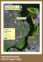
Work on Linking Quincy Riverwalk to Squantum Point Begins


 Click for larger image

From the Neponset River Watershed Alliance blog


The City of Quincy has authorized the Neponset River Watershed Association to proceed on constructing the final portion of the two mile long northern section of the Quincy Neponset Riverwalk. Once the project is complete, theRiverwalk will run along the Neponset Estuary from the pile-supported gazebo at Adams Inn north to Squantum Point in DCR’s Squantum Point Park. The Watershed Association hopes to have the work completed by next spring, with an official opening in the summer of 2014. The Association this week authorized its consultant for the project, Park Planning Associates, to start work.

The City of Quincy is providing $98,000.00 in Community Preservation Act funds for the project, with the Watershed Association putting in $32,000 of its own from the proceeds of a settlement with a developer several years ago. The Association also plans to fund the addition of benches, signage and other amenities along other portions of the Riverwalk before it opens.

There is currently a public waterfront walkway all the way around the Boston Scientific building on Commander Shea Blvd, and this project will connect it to walkways in Squantum Point Park. It will be built along an overgrown, largely buried and impassable taxiway that was built to service the Naval Air Station which occupied Squantum Point from 1923 to 1953. The area is owned by Boston Scientific and the MA Department of Conservation and Recreation.

The currently open portions of the Riverwalk run from the waterfront of Adams Inn, under the 3A highway bridge to Dorchester, across the Neponset Landing property, under the MBTA Red line bridge and out to Commander Shea Boulevard. Commander Shea, which is owned by the Boston Scientific Corporation, has public sidewalks and Boston Scientific has authorized the Watershed Association to add Riverwalk signage and benches. As noted above, a walkway around Boston Scientific was constructed many years ago and includes a natural beach area for launching canoes and kayaks.

The “Conceptual Plan for the Neponset Riverwalk” was published in 2002 by the Neponset River Watershed Association and the Friends of the Neponset Estuary, with assistance from the Quincy Environmental Network. Since that time the Watershed Association has negotiated public easement agreements with private waterfront property owners and the City of Quincy has produced a number of important studies, including the “Preliminary Design Report – Northern Section” in 2007. Quincy City Councilors Kevin Coughlin, Margaret Laforest and Douglas Gutro also helped resolve a number of disputes amongst Quincy residents about some amenities along the Riverwalk.

For more information, contact Neponset River Watershed Association Advocacy Director Steve Pearlman (781-575-0354 ext. 304; pearlman@neponset.org or Executive Director Ian Cooke (781-575-0354 ext. 305; cooke@neponset.org)

Wednesday, October 30, 2013

Did you Know? Keeping Watersheds Healthy as the Climate Changes

By Dorie Stolley, Watershed Action Alliance Coordinator and Outreach Manager


Raining cats and dogs
Does it seem like rain is falling harder these days compared to year past? It’s not an illusion. Here in New England, it’s raining more and with greater intensity due to climate change. Between 1960 and 2010, the total amount of precipitation we receive in Massachusetts in one year increased by about 10%. In Boston, that has meant a change from 40 to 45 inches, and over time more of that precipitation is coming in heavy downpours.  

This presents a challenge to maintaining healthy watersheds. Big, heavy raindrops slamming down forcefully on bare dirt wash a lot of soil into the waterways. Also, when a lot of rain falls in a short time, the ground is unable to absorb it all. The water runs off the surface, washing through lawns, yards and streets and down hills, picking up pollutants, sediment and trash as it heads toward our streams and rivers. And, if an area is mostly covered with asphalt and pavement, so-called impervious surfaces, runoff rates are even higher.  

There are important things to do in your backyard, in your town and in new developments to lessen the impacts of greater and heavier precipitation on water quality.

One of the most important strategies in your yard or in your town is to plant and maintain riparian buffers, dense planted areas next to streams and ponds. The vegetation breaks the force of the water as it falls preventing it from eroding as much soil. Buffers also slow the water’s rush downhill and filter out pollutants.

Rain garden next to Great Herring Pond in Plymouth, MA
Individual homeowners and municipalities can also maintain grassy swales, or vegetated ditches that run along contours, where water can collect during a storm, travel more slowly to waterways and percolate into the soil.  Another common tool is the rain garden, a depression in the soil planted with a variety of native plants to filter and uptake greater quantities of water while also beautifying an area and providing food for pollinating insects.

Wherever your town is considering allowing new developments, it is very important to keep climate change in mind to keep water quality high. Reducing the amount of allowable impervious surface promotes a healthy watershed. This can be done by clustering houses together and leaving natural areas free from development, which can then double as recreation amenities, such as hiking trails.

Want to find out more about your watershed? Visit: www.watershedaction.org

Tuesday, October 29, 2013

A Day in the Life: Save the Bay--Narragansett Bay!

Today’s blogger is Shalen!

One of Save the Bay's education vessels, the Alletta Morris!
Last week I had the great pleasure of exploring the Narragansett Bay watershed with Dorie, thanks to Topher Hamblett, Director of Advocacy and Policy at Save the Bay, and Rachel Calabro, Community Organizer and Advocate. I also had the honor of meeting Tom Kutcher, Narragansett Bay Keeper, and Bridget Prescott, Director of Education while down in Rhode Island at the Save the Bay Center.

Founded in 1970, one of the first issues on which Save the Bay worked was opposing a proposed nuclear energy facility on the bay in North Kingstown, Rhode Island. In its early years, this grassroots organization fought off other proposed energy facilities and worked to limit the industrialization of the Bay. Today, the Bay is used for fishing, boating, education, walking, and picnicking, thanks in large part to the efforts over the years of Save the Bay.

The programs of Save the Bay evolve to fit the issues of the times. For example, in the 1980s, Save the Bay (STB) focused on water pollution, and was very policy-oriented. Then in the 90s, they established the Baykeeper program, an on-the-water advocacy and watchdog program, and developed water quality monitoring protocols. The organization has a strong emphasis on restoring habitat, including saltmarsh, eelgrass beds, shellfish beds, and riverine sites. Right now, STB is concentrating on climate change, and sea level rise adaptation, focusing on issues such as shoreline erosion, stormwater pollution, water warming, and saltmarsh restoration (especially in the wake of Hurricane Sandy). One way STB is working to prevent shoreline erosion is to soften the shoreline by planting. A soft shoreline absorbs much of the force of the waves diminishing their destructive power. In contrast, waves rebound off a hard shoreline, such as seawall, scouring away soil, sand and plants. Some of the grasses planted are grown by the children in STB’s programs, allowing these local kids to be plugged into current issues and watershed preservation.

A mural in one of the Save the Bay Center classrooms
Save the Bay offers opportunities for children and adults to explore and learn about the Bay so in turn they will feel an attachment to and responsibility for the Bay and its watershed. The Save the Bay Center, completed in 2005, allowed the education program to expand and features multiple classrooms for labs and learning. It is built on a remediated landfill and incorporates many environmentally smart features such as recycled flooring, ambient light, a green roof and solar panels.  Kids also get to travel on the education vessels Elizabeth Morris and Alletta Morris (which we got to board down at the docks!), as “floating classrooms.” Right now, more than 15,000 children participate in the programs the Center offers. STB intends to expand their education programs into Massachusetts, as well, and are working on a pilot program to test in Fall River. STB works with public, private, and charter schools. 

Years ago clogged with sewage and poisoned by toxins, Narragansett Bay has come a long way thanks to Save the Bay. Covering a 147-square mile area, the Bay’s watershed is home to about 1.8 million people (in Massachusetts and Rhode Island), and over 12 million people visit the Bay every year. The watershed includes sections of Massachusetts, Rhode Island, and Connecticut. The Blackstone and Taunton Rivers are the largest sources of freshwater to the Bay. The Pawtuxet River is the largest sub-watershed fully within Rhode Island. The Wood-Pawcatuck River watershed drains much of western Rhode Island and parts of Connecticut, feeding into Little Narragansett Bay in Westerly, Rhode Island. Save The Bay also has a South County Coastkeeper who focuses on the southern Rhode Island shoreline and the salt ponds. Numerous small watersheds drain into Narragansett Bay as well.

After exploring one of the education vessels, we began our tour of various spots in the Narragansett Bay watershed. We first traveled up Interstate Highway 95 and I noticed immediately how similar this and the Neponset River watershed are, as they are both urban watersheds. Despite the developed location, one of STB’s priorities is public access to the Bay and its nearby waterways for enjoyment and recreation.

Slater Mill, Pawtucket RI
We visited the Blackstone River Visitor’s Center in Pawtucket, RI, and learned about the urbanization along the river due to the Industrial Revolution, evidenced by the historic Slater Mill across the street. This river used to be a boundary marker for the territory of the Wampanoag and Narragansett Native American tribes, and was once resource-rich and teeming with life.

Departing from Slater Mill, we journeyed south back into Providence to visit WaterPlace Park, near the Providence Place Mall. In the 1990s, this tidal lagoon, part of the Woonasquatucket River, was reclaimed by opening up the river, which was buried under the city. Concerts and various events are held in the park, a great attraction for revitalizing the community. In my opinion, this park might motivate people to think more about the effects of climate change. It has dramatically flooded on occasion due to the combination of heavier rainfall and sea level rise – both results of climate change. When people see this beloved landmark affected by the elements it might spur them to fight climate change by reducing carbon emissions.

As we drove through Providence, I noticed how visible, open, and inviting the Moshassuck River was as it winds through the city. The Moshassuck eventually combines with the Woonasquatucket River to form the Providence River. The rivers in Providence are truly centerpieces now, and are very much visible, which increases the public’s desire for access.

We passed by the huge hurricane barriers built after the 1954 hurricane, designed to prevent all but minimal flooding to the city during big storm events. Unfortunately salt piles and scrap metal yards adorn the flood zone, and pose a risk of polluting the bay during times of significant flooding.

Continuing down the road from the scrap metal yards, we passed by Johnson and Wales University, coming to the sewage treatment plant, just shy of the Save the Bay Center. The plant services more than 300,000 people, and to offset its energy consumption by about two-thirds, the plant constructed wind turbines. Before resuming our tour, we stopped at the STB Center for lunch outside on picnic tables facing the Bay.

Rachel Calabro was kind enough to take Dorie and me from there to a dam removal site along the Pawtuxet River, on the town line of Warwick and Cranston. The cement dam was built on the residing bedrock and was used to prevent the tide from rising too far up the river and to keep the water fresh. Inevitably, the impounded water became polluted and the dam was removed so the river can flow down the natural waterfall there and allow passage for the fish to travel upstream.

Our final destination was Stillhouse Cove, where Wenley Ferguson, Director of Habitat Restoration, was working with volunteers on a marsh restoration project. She is recreating a natural vegetated barrier for the shoreline, which inches dangerously close to the nearby road and neighborhood due to runoff from high-density development and damage from continual storms. When Hurricane Sandy hit, the shoreline here was heavily eroded. Right now, Wenley and her team are seeding the edge of the marsh with warm season grasses.
Stillhouse Cove
My day at Save the Bay was inspiring to say the least. To see the vigor and excitement with which these dedicated people work to protect and restore Narragansett Bay left me with hope: with perseverance, we can combat environmental degradation and make this world a healthier place for not just humans but all beings.
To learn more about Save The Bay, become a member and/or volunteer, please visit their site here: https://www.savebay.org/. Don’t forget to like them on Facebook and follow them on Twitter.


Want to learn more about your local watershed? Visit WAA’s site here to learn more: http://watershedaction.org/