Alliance Members

Back Bay Watershed Association
Eel River Watershed Association
Herring Ponds Watershed Association
Jones River Watershed Association
Neponset River Watershed Association
North and South Rivers Watershed Association
Pembroke Watershed Association
Save the Bay: Narragansett Bay
Six Ponds Improvement Association
Taunton River Watershed Association
Weir River Watershed Association
Westport River Watershed Alliance

Monday, July 29, 2013

"Did You Know?" Community Building through Watershed Recreation

“Did You Know?”
Community-Building through Watershed Recreation
By Shalen Lowell

Everybody needs beauty as well as bread, places to play in and pray in, where nature may heal and cheer and give strength to body and soul.”

So wrote John Muir in his 1912 book, The Yosemite. Muir spoke of the restorative quality of our natural environments, and as such recognizes them as integral parts of our lives. Much as we can benefit from nature in its spiritual as well as material resources, we must recognize what we can do to repay the environments in which we live.

Dorie Stolley, "Great River Race Preparation"
As many of the southeastern Massachusetts watershed associations realize, one of the best ways to get people, whether adults, children, concerned citizens, or budding environmental activists, involved in their communities is through recreational activities. Many of these associations bolster this sense of community with volunteer opportunities. Some volunteering does not require a big commitment but, nonetheless, gets people out for a fun and active day as a means of contribution.

Participating in river herring counts encourages people to take action and learn about the environment of their community, in a small and simple way. Herring counts determine how many herring are returning to a system or how many are blocked by a specific dam, and citizen involvement is a perfect and manageable way to help. Two organizations, the North and South Rivers Watershed Association  (NSRWA) and the Jones River Watershed Association (JRWA) accept volunteers in the spring to assist with herring counts, and for the JRWA this occurs at the Elm Street dam in Kingston, Massachusetts.

The JRWA also sponsors other enjoyable activities such as a summer hiking series, family-friendly hikes from Jones River headwaters to Kingston Bay. Other recreation in the Jones River watershed includes boating from Kingston Bay out to Cape Cod Bay, and canoeing and kayaking from Mulliken's Landing, a put-in on the Jones River.

Shalen Lowell, "Neponset River Reservation"
The Neponset River Watershed Association (NepRWA) also recruits volunteers to bolster community-building efforts with their Citizen Water Monitoring Network (CWMN), for which volunteers help with water sampling in Neponset waterways. Public parks in the Neponset watershed provide great recreation opportunities. Where the Neponset empties into Dorchester Bay sits Squantum Point Park, a former Navy airfield. The Lower Neponset River Trail, a multi-purpose trail and “corridor park” that runs along the Neponset River and alongside old railroad tracks, is ideal for cycling, running and walking because of its seclusion from traffic and resting spots that include information about local wildlife and maps. The Neponset watershed also has a boat launch at the Neponset estuary.

The recreational activities of the North and South Rivers watershed are similar to Neponset’s. Kayaking, canoeing, and motor boating abound in the North River. Residents along the river build decks to which they dock their boats and from which they fish or jump into the river to enjoy its cool waters by swimming. The NSRWA also sponsors many other fun activities, such as water quality monitoring by volunteers (like the NepRWA), the Great River Race, Yoga at the River’s Edge, and River Cleanup Days.

Much like the North River, Great Herring Pond, of the Herring Ponds watershed, is a hotspot for water recreation. Residents in Plymouth and Bourne partake in swimming, kayaking, fishing, sailing, and even jet skiing. There is a Great Herring Pond public access boat launch in Bourne from which people depart into the pond. Little Herring Pond has a public access point as well for canoeing and kayaking, however motor boating is forbidden because of its shallow waters.

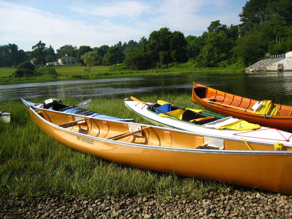
Shalen Lowell, "The NSRWA Great River Race"
The Little and Great Herring Ponds are two of the activity hubs in this watershed, over which the Herring Ponds Watershed Association (HPWA) watches. In this watershed, there are many parks and day camps as well: Camp Clark, just ashore of Hyles Pond, is a YMCA day camp for children and has nature trails and swimming; Hedges Pond Recreational Area is a Plymouth town park open to the public on afternoons and weekends. There is a Massachusetts Maritime Academy facility on Great Herring Pond that offers sailing lessons and rowing. The Carter Beal Reservation Area just to the south has a lovely park and trails. Finally, the Herring Run Recreation Area along Cape Cod Canal fronts a paved pedestrian trail, which is closed to traffic and used for biking, jogging, and walking and the Canal abounds with boats.

Just as outdoor recreation is important for our spirits and health, it is equally as vital to community-building and connecting networks of dedicated citizens. These ponds, rivers, and parks not only bring us together, but teach us to appreciate the inherent value of our environments and a desire to preserve them.

If you would like to volunteer and be active in your community contact your local watershed association today. To learn more about the southeastern Massachusetts watersheds and how to contact your local watershed association visit the Watershed Action Alliance website and http://watershedaction.org/index.php/watershed-matters/know-your-watershed

Thursday, July 25, 2013

The 2013 Great River Race!

Today’s Blogger is Shalen!
Shalen kayaking the 2013 Wampanoag Paddle.

What energy and excitement I experienced at the NSRWA’s Great River Race last Saturday! Organized by the North and South Rivers Watershed Association and authorized by the American Canoe Association (a national, nonprofit organization that sanctions programs and events to promote recreation of “paddlesport,” and influences stewardship issues that effect paddlers), this year’s race involved 81 participants and was truly a great success thanks to the over 20 volunteers at the event!

I volunteered at the race, which made it all the more exhilarating (not as much as if I was a participant, but I’m sure I’ll be paddling next year!) The 7-mile race on the North River began at the Union Street Bridge in Norwell, Massachusetts. I helped unload various boats from participant’s vehicles so they could park, mingle, and prepare before launching boats and gathering at the starting line. All the excitement from the preparation of those people racing and those helping on the sidelines was infectious. Despite the intense humidity of the morning, our spirits were high. Finally the racers gathered in the North River and I saw them blast right under where I stood on the Union Street Bridge. Seeing the various vibrantly colored boats as the racers dashed under the bridge and upstream was astonishing.

There were three stand-up paddle boarders this year, and each had incredible perseverance in the race! When Craig Prentiss, one of these paddlers, crossed the finish line on a racing board he had quite a crowd cheering him on, me included. I admired these paddlers, especially their determination despite the oppressive heat and their balance. I can’t imagine the practice it must take to master a paddle board.

The race ended at the Washington Street Bridge on the Hanover/Pembroke town line. I chatted with a few of the contestants’ relatives, a line of people eagerly waiting along the bridge for the racers to finish. Quite a crowd gathered and I finally saw clusters of canoes and kayaks paddling under the flagged finish line, resting and hydrating before heading farther upstream to the takeout point. Dorie and I visited the pickup point at the Hanover Canoe Launch to cheer, congratulate the racers, and assist them in loading up their boats.

The day’s schedule concluded with a well-deserved party and awards ceremony with prizes for each of the participant categories (i.e., single kayak, double kayak, single canoe, and stand-up paddle board). Events such as the Great River Race instill a sense of community for all those who are members of NSRWA, but also river recreation aficionados and those people who just love to have a great time! Whether young or old, racing or cheering, all those involved enjoyed themselves in this spectacular event.


To learn more about the NSRWA, please visit their site at http://www.nsrwa.org/. In addition to the Great River Race, the NSRWA has many other fantastic events, just in time for summer and outdoor recreation, which you can find by following this link: http://www.nsrwa.org/Page.145.html.

Find out more about the American Canoe Association, their commitment to stewardship, “paddlesport,” and healthy recreation by visiting http://www.americancanoe.org/?page=About_Us.

Want to learn more about Watershed Action Alliance, our mission, your local watershed and more? Check out http://watershedaction.org/

Monday, July 15, 2013

Welcome to WAA, Herring Ponds Watershed Association!

Today’s blogger is Shalen!

Little Herring Pond public access point
Lee Pulis, of the Herring Ponds Watershed Association which was founded in 2007 as a volunteer neighborhood organization, was kind enough to take us on a tour of the Herring Ponds watershed last Thursday! The HPWA is WAA's newest member! This watershed is not a hydrologic watershed but a state-d
esignated area of critical environmental concern (ACEC), with politically designated boundaries (one of which is Rt. 3). The ACEC is an important area for recreation as well as for water supply, as most of its residents draw from the Plymouth-Carver Aquifer. In addition to sampling pond water and storm water runoff, the HPWA commits to educating residents about their watershed and promoting boating and recreational safety.

The highlights of this watershed are the Little and Great Herring Ponds. Little Herring Pond (I will use the abbreviation LHP for brevity) is at maximum 5 feet deep. Its northern waters never freeze, so aquatic plants abound and it is a great fish pond. Motor boats are not allowed on LHP, and because of this there are no invasive species which often spread by boats and their trailers.

Great Herring Pond (GHP), however is much larger: its waters span 376 acres and are at least 20 feet deep. It receives 80% of its water from the LHP. The state requires a 100-foot buffer zone for any construction around its shores, because of its designation as one of the great Massachusetts ponds. Of course there are many grandfathered homes all around the shoreline, so buffer zone stewardship education is a prime mission of HPWA. Carter’s River flows downstream from LHP to GHP.

At the Carter Beal Conservation Area
Our first stop in this watershed was the Ponds of Plymouth housing development on the western edge of LHP. We saw lots of large expanses of irrigated lawn with non-native decorative plants. Just off one of the development’s roads is Pickerel Pond, part of The Wildlands Trust.

Water recreation is an important attraction in the Herring Ponds watershed. This watershed not only boasts residential properties along the shores of both ponds, but also many parks and day camp areas for adults and kids alike. Two such properties are Camp Clark and Hedges Pond Recreational Area. The former is a YMCA day camp for kids, has horses, nature trails, and offers swimming in Hyles Pond. The latter is a recreation area open to the public on afternoons and weekends, and which used to be an church nature camp.

After a quick interlude, in which we allowed a portion of the pouring rain to pass, we headed south along LHP’s western shores and encountered considerable runoff from the rain heading into Carter’s River, the water body connecting the two main ponds.

We drove past Parcel 15, an area of inactive cranberry bogs, between LHP and GHP. The town missed the deadline of exercising first right of refusal to buy it, and there’s a battle as to whether this land will be reactivated and two more houses with septic systems will be built on the land nearby.The Plymouth Community Preservation Community has since met and indicated it has the funds and will encourage Selectmen to correct the mistake and preserve this area to protect area water quality and recreation. Keep an eye out for further updates.

From thereon we ventured to the LHP public access point, which leads to the northeast part of GHP, and at which was a flow gauge. The wooded path leading to this outlet was rife with horrid construction materials and used electronics dumping. A short distance away, I saw a rain garden for the first time (see right), near the shores of GHP, constructed as the surface part of an underground stormwater filtration system.

Further down GHP’s southwestern shores sits a Massachusetts Maritime Academy sailing facility, offering rowing and sailing lessons, among other recreational activities. This facility is also one of the few places in the world you can learn to drive an oil tanker by training on a 1/12th working scale model. Pretty cool!

We next observed a few passing locations including a Native American burial ground, another flow gauge towards the end of the Herring River, a boat launch in Bourne, and the Carter Beal Conservation Area, which included a fish ladder.

We reached the Herring River’s outlet by late afternoon: it flows into Cape Cod Canal, and it is at this location that herring swim up the river near the Herring Run Recreation Center. This center provides people with a view of the river (and sometimes herring!), information regarding the contribution of herring to the watershed, the Sagamore Bridge, and a recreation road dedicated purely to biking and pedestrian activities, much like the Neponset River Trail that I visited several weeks ago. This trip was a refreshing and amazing one, one during which I learned how watershed recreation creates an active community among an area’s residents!

Want to learn more about the Herring Ponds Watershed Association or volunteer in any of their activities? Visit their website http://www.theherringpondswatershed.org/Home_Page.php and check out their landmark stewardship guide at http://www.theherringpondswatershed.org/uploads/HPWA_Stewardship_Guide.pdf.

See the following link to learn more about the Lower Neponset River Trail: http://bostonharborwalk.com/placestogo/location.php?nid=2&sid=63

Wednesday, July 3, 2013

Kayaking on the North River!

Today’s Blogger is Shalen Lowell!

I’m always diving into new things, so last week I went kayaking for the first time! As part of the 2013 Wampanoag Paddle Fundraiser, Dorie and I paddled the 12.5 mile first leg of the Wampanoag canoe passage to experience first-hand the North and South Rivers watershed.

This watershed comprises 12 towns including Norwell, Scituate, Hingham, Hanover, Pembroke, and Weymouth, is an expansive watershed, and was known for shipbuilding. Used as channels for melt water when the glacier moved north around 10,000 years ago, the North and South Rivers surround 3,000 acres of salt marsh and 2,000 acres of endangered species habitat. The North River rises the from marshes and springs in Weymouth, Rockland and Hanson, emptying into the Atlantic, and the South River’s source is Round Pond in Duxbury.

The watershed’s topography is dynamic: for instance, as the rivers deposited silt, the salt marshes extended, keeping up with the sea level rise. The watershed lowlands contain fresh and salt water marshes, crucial for stormwater runoff and habitats for local wildlife, whereas a small section for the uplands is used for agriculture.

The NSRWA is working on Third Herring Brook, a tributary of the North River. As of now, herring can only access the bottom part of the watershed system, and have trouble moving upstream. There is only a 26% passage outflow in the fall. The Third Herring Brook has four dams that traverse its main stem. The NSRWA is working to take out one dam, funded by the YMCA, which is hesitant to go through with the dam destruction because of a lack of funds.


Peter Kelly-Detwiler and Nik Tyack once again paddled the 72-mile long passage mentioned above to raise money for the North and South Rivers Watershed Association. In a statement about their fundraiser, Peter and Nik said, “We hope to both raise awareness of Massachusetts' beautiful rivers and also support the North and South Rivers Watershed Association in their pioneering efforts to preserve and restore the watershed we grew up in. Recent successes of the organization include bringing river herring back to Scituate's First Herring Brook and re-opening shellfish beds on the South River.”

We kayaked down Herring River from the Driftway Park in Scituate, to where the Herring meets the North in proximity to the ocean. We then entered up the North River. I traveled with Dorie half the time, and the other half by myself; as a writer some reflection time suits me well.  Upon reflection, the journey seems a blur of riverside docks and waterfront properties, sprawling forests, and tall grasses. I do, however, remember feeling exhilaration as I swept down the river and jetted right under a highway overpass. Nothing pumps me up like the adrenaline of emerging under a bridge and into the open for a new adventure. I tired quickly by the end of my journey and my arms ached the entire day after! The repercussions were well-worth the experience though.

This journey was a unique one. So far, I’ve been viewing the southeastern MA watersheds and their main waterways from their shores, looking at the rivers. But instead of touring the watershed land, we were actually on the water, where I was able to gain a different perspective. We literally traversed the land as if we, too, were the North River.

This perspective led to an overwhelming contemplation about the North River: I thought about just this one river, and the countless ecosystems it encompasses, which broadened to the North and South Rivers watershed, to the millions of waterways in this country and in the world, the minute and fragile, interlocking environments. Each environment is its own, and also connects to all others; each one is vital to its environment and to the lives of organisms around the world. I also imagined what it was like for the Wampanoag Native Americans to have to traverse the waters, how taxing, frustrating, and rewarding it must have been.

Thanks to this experience, I’ve found that kayaking is something I could see myself doing long-term. A big shout out to the NSRWA for sponsoring this fun and successful event and for their ongoing work on ecosystem restoration in the watershed! If you want to learn more about the North and South Rivers watershed or NSRWA’s advocacy, history, and volunteer opportunities, visit http://www.nsrwa.org/ or log onto http://watershedaction.org/.