Alliance Members

Back Bay Watershed Association
Eel River Watershed Association
Herring Ponds Watershed Association
Jones River Watershed Association
Neponset River Watershed Association
North and South Rivers Watershed Association
Pembroke Watershed Association
Save the Bay: Narragansett Bay
Six Ponds Improvement Association
Taunton River Watershed Association
Weir River Watershed Association
Westport River Watershed Alliance

Showing posts with label watershed. Show all posts

Tuesday, May 19, 2015

The Future of Water in Southeastern Mass: It’s Up to Us

By Shalen Lowell, WAA Social Media Manager 

“If there is magic on this planet, it is contained in water.” –Loren Eisley

Photo
Photo credit to Shalen Lowell
Passion, persistence, public engagement and community: these are some of the crucial takeaways from “The Future of Water in Southeastern Massachusetts,” an environmental networking conference co-hosted by the Watershed Action Alliance and Plimoth Plantation. Our mission for the conference, held April 24th, was to gather concerned citizens, conservation professionals, legislators, volunteers, and all those committed to preserving and protecting the waters of Southeastern Massachusetts. Our goal was to network and further strategize about how best to combat the issues in Southeastern Mass watersheds, including stormwater and wastewater concerns, dam removal, and health concerns effecting environmental recreation.

WAA’s conference consisted of seven engaging, enlightening and thoughtful panels: Fundraising for Nonprofits, Science and Data Collection, Outreach and Education, Stormwater, Drinking Water in Southeastern Massachusetts, Wastewater, and Recreational Waters. (For a summary of the panels, click here.) Eric Walberg of the Manomet Center for Conservation Sciences presented as our guest plenary speaker on water resource preservation and watershed management in the face of climate change. You can catch Eric’s talk and all of the sessions on WAA’s Youtube channel.

Photo
Gorgeous view from the conference pavilion
(Shalen Lowell)
As social media manager for WAA, I was responsible for live-tweeting about all of the panels at our conference. At times such as these, I especially see the real value in how social media platforms enhance our relationships with member watershed associations, our Twitter followers and other environmentally affiliated associations in the region. People unable to attend the conference were able to follow along with the panels as I tweeted from our account with our conference hashtag #thefutureofwater. Please check out our Twitter platform @Watershed_AA to view our tweets from the day, and don’t forget to follow us, too!

My personal favorite panels were Stormwater and Fundraising for Nonprofits. Especially with regard to stormwater, my renewed interest in, and dedication to, the issue goes back to my last year at Stonehill College, when I was a Teaching Assistant for a Learning Community (LC) seminar entitled Stonehill’s Water. That semester, I assisted the LC students in drawing up proposals for stormwater solutions for the town of Brockton, MA, and I had an active part in the writing and presentation processes. Some of the solutions with which the students engaged (many of which were addressed in the stormwater panel below) included updating to more stable green infrastructure systems and continued education and outreach.

The stormwater panelists for WAA’s event included Martin Pillsbury (Environmental Director at the Metropolitan Area Planning Council), Debbie Cook (Communications Director at the North and South Rivers Watershed Association), and Newton Tedder (of EPA Region 1), with Ian Cooke, Executive Director of the Neponset River Watershed Association as moderator. The new EPA municipal stormwater permit provided inspiration for this panel, requiring a renewed effort in stormwater management for nonprofits, local agencies, and municipalities. The new permit will thus hold communities more responsible for dealing with stormwater issues. The panelists emphasized intra-watershed coordination and cooperation with regard to combating environmental degradation and especially stormwater concerns. When asked to identify “sleeper” stormwater issues, the panelists called attention to the following: effective design of green infrastructure, land use, and public education and participation. The takeaway? When it comes to stormwater, we need to take real action now, and to enhance communication and cooperation between all those players involved in ameliorating the issue.

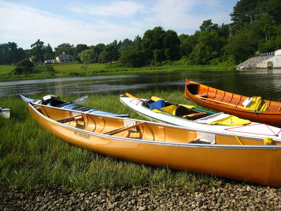
Photo taken during the Recreational Waters panel
(Shalen Lowell)
Another of my favorite panels was Fundraising for Nonprofits. Samantha Woods, Executive Director of the North and South Rivers Watershed Association, moderated, and the panelist speakers were the following: Bill Stanton (former Executive Director of the NSRWA), Sarah Kelley (Senior Program Officer of the Island Foundation), and Bethany Kendall (President and CEO of the Executive Service Corps New England). One of the most important notes I took away from this panel was also one which I had not before considered: one of the keys to funding an effective nonprofit is widening one’s scope. Several of the panelists advised looking outside local areas and tying in a nonprofit’s specific focus to other regions and wider national issues, in order to network with other organizations engaged in these issues and perhaps receive additional funding. Emphasis was also placed on donor relations (you can never thank them enough!). Most important of all, however, is personal networking. I have experienced this often enough in my personal interaction with WAA’s member watershed associations, and with the inspiring individuals in them. All the panels are now available on WAA’s YouTube channel.

Photo credit to Shalen Lowell
I was excited to make contact with those individuals I know from our member watershed associations but had not seen in quite a while! It was great to chat again in person with these hard-working and inspiring individuals that I met way back in my WAA intern days. It’s important to maintain these personal connections. On a similar note, one of the many successful outcomes to the conference was networking: networking between individuals of all different backgrounds and occupations in the region uniting with one focus in mind: the future and health of water in Southeastern Massachusetts.

To read more about this conference, the people and organizations involved, and more, please check out this article by Frank Mand of the Old Colony Memorial, another of the conference’s enigmatic attendants!


Saturday, February 8, 2014

"Going with the Flow": Improving Watershed Resiliency

From the U.S Fish and Wildlife Service, Northeast, originally posted on the USFWS Northeast blog on February 6, 2014.

The humble road culvert is the centerpiece of a region-wide effort to help fish and wildlife and protect communities in the Northeast.

The critical role of culverts — essentially big pipes or concrete boxes carrying streams beneath roads—was demonstrated dramatically in a series of powerful storms hitting the Northeast in recent years. In 2011, intense and sustained rain from Hurricane Irene and Tropical Storm Lee washed out roads throughout mountains of New York and New England as culverts running under those roads were not designed to handle such enormous volumes of water.  Flooding from Hurricane Sandy, which lashed the Northeast coast and adjacent inland areas in October 2012, caused additional damage.
Fish-friendly culverts also can help reduce the likelihood
of damage to road stream crossings from future floods.
The widespread effects of these storms – which scientists say will become a more frequent calling card of climate change – underscore the need for science that can help local, state, and federal partners throughout the region prioritize and increase the resiliency of roads to floods.
To meet this need, the U.S. Fish and Wildlife Service is working through the North Atlantic Landscape Conservation Cooperative to coordinate and support a collaborative, region-wide effort to restore fish passage while reducing the likelihood of damage to  road stream crossings from future floods. The project is supported by $1.27 million in Hurricane Sandy mitigation funds from the Department of the Interior.


Improving the resiliency of roads has multiple benefits beyond protecting human health, safety, and property. Upgrading, repairing or replacing culverts can also increase connectivity and movement of fish and wildlife. This addresses a critical problem because aquatic systems in the Northeast are extremely fragmented by undersized or damaged road culverts that restrict passage for fish, other aquatic organisms and wildlife. Beyond their in-stream benefits, fish-friendly culverts also help sustain nearby wetlands and floodplains while they nourish coastal beaches with sediment. It’s a bang-for-the-buck conservation investment that can pay big dividends for wildlife and people.
The culvert project underscores a key role of the North Atlantic LCC in bringing the Northeast conservation community together to address priority science needs and inform conservation decisions in the face of change and uncertainty. The project will compile information on locations and condition assessments of road stream crossings based on existing data and models; support additional surveys of road stream crossings; predict future storm discharge levels; and assess risk and prioritize crossing improvements.  The resulting regionally-consistent data on stream crossing locations and future flood conditions will help towns, states and communities manage future intense storms and improve conditions for aquatic organisms.  The USFWS Fisheries Program will help facilitate the effort with the LCC guided by partners and users from the conservation, transportation, and state and municipal planning sectors.
The project will take place over three years in coastal watersheds in New Jersey, Delaware, Connecticut, Rhode Island, Massachusetts, Maryland and Virginia. Partners include USFWS, the Nature Conservancy, Trout Unlimited and the U.S. Forest Service. In addition to the DOI funding, North Atlantic LCC partners are contributing $150,000 in matching funds to expand the project to include additional Northeast states.


Click here to view additional details on the project and participating partners.


To read the original post, click here.

Tuesday, October 29, 2013

A Day in the Life: Save the Bay--Narragansett Bay!

Today’s blogger is Shalen!

One of Save the Bay's education vessels, the Alletta Morris!
Last week I had the great pleasure of exploring the Narragansett Bay watershed with Dorie, thanks to Topher Hamblett, Director of Advocacy and Policy at Save the Bay, and Rachel Calabro, Community Organizer and Advocate. I also had the honor of meeting Tom Kutcher, Narragansett Bay Keeper, and Bridget Prescott, Director of Education while down in Rhode Island at the Save the Bay Center.

Founded in 1970, one of the first issues on which Save the Bay worked was opposing a proposed nuclear energy facility on the bay in North Kingstown, Rhode Island. In its early years, this grassroots organization fought off other proposed energy facilities and worked to limit the industrialization of the Bay. Today, the Bay is used for fishing, boating, education, walking, and picnicking, thanks in large part to the efforts over the years of Save the Bay.

The programs of Save the Bay evolve to fit the issues of the times. For example, in the 1980s, Save the Bay (STB) focused on water pollution, and was very policy-oriented. Then in the 90s, they established the Baykeeper program, an on-the-water advocacy and watchdog program, and developed water quality monitoring protocols. The organization has a strong emphasis on restoring habitat, including saltmarsh, eelgrass beds, shellfish beds, and riverine sites. Right now, STB is concentrating on climate change, and sea level rise adaptation, focusing on issues such as shoreline erosion, stormwater pollution, water warming, and saltmarsh restoration (especially in the wake of Hurricane Sandy). One way STB is working to prevent shoreline erosion is to soften the shoreline by planting. A soft shoreline absorbs much of the force of the waves diminishing their destructive power. In contrast, waves rebound off a hard shoreline, such as seawall, scouring away soil, sand and plants. Some of the grasses planted are grown by the children in STB’s programs, allowing these local kids to be plugged into current issues and watershed preservation.

A mural in one of the Save the Bay Center classrooms
Save the Bay offers opportunities for children and adults to explore and learn about the Bay so in turn they will feel an attachment to and responsibility for the Bay and its watershed. The Save the Bay Center, completed in 2005, allowed the education program to expand and features multiple classrooms for labs and learning. It is built on a remediated landfill and incorporates many environmentally smart features such as recycled flooring, ambient light, a green roof and solar panels.  Kids also get to travel on the education vessels Elizabeth Morris and Alletta Morris (which we got to board down at the docks!), as “floating classrooms.” Right now, more than 15,000 children participate in the programs the Center offers. STB intends to expand their education programs into Massachusetts, as well, and are working on a pilot program to test in Fall River. STB works with public, private, and charter schools. 

Years ago clogged with sewage and poisoned by toxins, Narragansett Bay has come a long way thanks to Save the Bay. Covering a 147-square mile area, the Bay’s watershed is home to about 1.8 million people (in Massachusetts and Rhode Island), and over 12 million people visit the Bay every year. The watershed includes sections of Massachusetts, Rhode Island, and Connecticut. The Blackstone and Taunton Rivers are the largest sources of freshwater to the Bay. The Pawtuxet River is the largest sub-watershed fully within Rhode Island. The Wood-Pawcatuck River watershed drains much of western Rhode Island and parts of Connecticut, feeding into Little Narragansett Bay in Westerly, Rhode Island. Save The Bay also has a South County Coastkeeper who focuses on the southern Rhode Island shoreline and the salt ponds. Numerous small watersheds drain into Narragansett Bay as well.

After exploring one of the education vessels, we began our tour of various spots in the Narragansett Bay watershed. We first traveled up Interstate Highway 95 and I noticed immediately how similar this and the Neponset River watershed are, as they are both urban watersheds. Despite the developed location, one of STB’s priorities is public access to the Bay and its nearby waterways for enjoyment and recreation.

Slater Mill, Pawtucket RI
We visited the Blackstone River Visitor’s Center in Pawtucket, RI, and learned about the urbanization along the river due to the Industrial Revolution, evidenced by the historic Slater Mill across the street. This river used to be a boundary marker for the territory of the Wampanoag and Narragansett Native American tribes, and was once resource-rich and teeming with life.

Departing from Slater Mill, we journeyed south back into Providence to visit WaterPlace Park, near the Providence Place Mall. In the 1990s, this tidal lagoon, part of the Woonasquatucket River, was reclaimed by opening up the river, which was buried under the city. Concerts and various events are held in the park, a great attraction for revitalizing the community. In my opinion, this park might motivate people to think more about the effects of climate change. It has dramatically flooded on occasion due to the combination of heavier rainfall and sea level rise – both results of climate change. When people see this beloved landmark affected by the elements it might spur them to fight climate change by reducing carbon emissions.

As we drove through Providence, I noticed how visible, open, and inviting the Moshassuck River was as it winds through the city. The Moshassuck eventually combines with the Woonasquatucket River to form the Providence River. The rivers in Providence are truly centerpieces now, and are very much visible, which increases the public’s desire for access.

We passed by the huge hurricane barriers built after the 1954 hurricane, designed to prevent all but minimal flooding to the city during big storm events. Unfortunately salt piles and scrap metal yards adorn the flood zone, and pose a risk of polluting the bay during times of significant flooding.

Continuing down the road from the scrap metal yards, we passed by Johnson and Wales University, coming to the sewage treatment plant, just shy of the Save the Bay Center. The plant services more than 300,000 people, and to offset its energy consumption by about two-thirds, the plant constructed wind turbines. Before resuming our tour, we stopped at the STB Center for lunch outside on picnic tables facing the Bay.

Rachel Calabro was kind enough to take Dorie and me from there to a dam removal site along the Pawtuxet River, on the town line of Warwick and Cranston. The cement dam was built on the residing bedrock and was used to prevent the tide from rising too far up the river and to keep the water fresh. Inevitably, the impounded water became polluted and the dam was removed so the river can flow down the natural waterfall there and allow passage for the fish to travel upstream.

Our final destination was Stillhouse Cove, where Wenley Ferguson, Director of Habitat Restoration, was working with volunteers on a marsh restoration project. She is recreating a natural vegetated barrier for the shoreline, which inches dangerously close to the nearby road and neighborhood due to runoff from high-density development and damage from continual storms. When Hurricane Sandy hit, the shoreline here was heavily eroded. Right now, Wenley and her team are seeding the edge of the marsh with warm season grasses.
Stillhouse Cove
My day at Save the Bay was inspiring to say the least. To see the vigor and excitement with which these dedicated people work to protect and restore Narragansett Bay left me with hope: with perseverance, we can combat environmental degradation and make this world a healthier place for not just humans but all beings.

To learn more about Save The Bay, become a member and/or volunteer, please visit their site here: https://www.savebay.org/. Don’t forget to like them on Facebook and follow them on Twitter.


Want to learn more about your local watershed? Visit WAA’s site here to learn more: http://watershedaction.org/

Monday, July 29, 2013

"Did You Know?" Community Building through Watershed Recreation

“Did You Know?”
Community-Building through Watershed Recreation
By Shalen Lowell

Everybody needs beauty as well as bread, places to play in and pray in, where nature may heal and cheer and give strength to body and soul.”

So wrote John Muir in his 1912 book, The Yosemite. Muir spoke of the restorative quality of our natural environments, and as such recognizes them as integral parts of our lives. Much as we can benefit from nature in its spiritual as well as material resources, we must recognize what we can do to repay the environments in which we live.

Dorie Stolley, "Great River Race Preparation"
As many of the southeastern Massachusetts watershed associations realize, one of the best ways to get people, whether adults, children, concerned citizens, or budding environmental activists, involved in their communities is through recreational activities. Many of these associations bolster this sense of community with volunteer opportunities. Some volunteering does not require a big commitment but, nonetheless, gets people out for a fun and active day as a means of contribution.

Participating in river herring counts encourages people to take action and learn about the environment of their community, in a small and simple way. Herring counts determine how many herring are returning to a system or how many are blocked by a specific dam, and citizen involvement is a perfect and manageable way to help. Two organizations, the North and South Rivers Watershed Association  (NSRWA) and the Jones River Watershed Association (JRWA) accept volunteers in the spring to assist with herring counts, and for the JRWA this occurs at the Elm Street dam in Kingston, Massachusetts.

The JRWA also sponsors other enjoyable activities such as a summer hiking series, family-friendly hikes from Jones River headwaters to Kingston Bay. Other recreation in the Jones River watershed includes boating from Kingston Bay out to Cape Cod Bay, and canoeing and kayaking from Mulliken's Landing, a put-in on the Jones River.

Shalen Lowell, "Neponset River Reservation"
The Neponset River Watershed Association (NepRWA) also recruits volunteers to bolster community-building efforts with their Citizen Water Monitoring Network (CWMN), for which volunteers help with water sampling in Neponset waterways. Public parks in the Neponset watershed provide great recreation opportunities. Where the Neponset empties into Dorchester Bay sits Squantum Point Park, a former Navy airfield. The Lower Neponset River Trail, a multi-purpose trail and “corridor park” that runs along the Neponset River and alongside old railroad tracks, is ideal for cycling, running and walking because of its seclusion from traffic and resting spots that include information about local wildlife and maps. The Neponset watershed also has a boat launch at the Neponset estuary.

The recreational activities of the North and South Rivers watershed are similar to Neponset’s. Kayaking, canoeing, and motor boating abound in the North River. Residents along the river build decks to which they dock their boats and from which they fish or jump into the river to enjoy its cool waters by swimming. The NSRWA also sponsors many other fun activities, such as water quality monitoring by volunteers (like the NepRWA), the Great River Race, Yoga at the River’s Edge, and River Cleanup Days.

Much like the North River, Great Herring Pond, of the Herring Ponds watershed, is a hotspot for water recreation. Residents in Plymouth and Bourne partake in swimming, kayaking, fishing, sailing, and even jet skiing. There is a Great Herring Pond public access boat launch in Bourne from which people depart into the pond. Little Herring Pond has a public access point as well for canoeing and kayaking, however motor boating is forbidden because of its shallow waters.

Shalen Lowell, "The NSRWA Great River Race"
The Little and Great Herring Ponds are two of the activity hubs in this watershed, over which the Herring Ponds Watershed Association (HPWA) watches. In this watershed, there are many parks and day camps as well: Camp Clark, just ashore of Hyles Pond, is a YMCA day camp for children and has nature trails and swimming; Hedges Pond Recreational Area is a Plymouth town park open to the public on afternoons and weekends. There is a Massachusetts Maritime Academy facility on Great Herring Pond that offers sailing lessons and rowing. The Carter Beal Reservation Area just to the south has a lovely park and trails. Finally, the Herring Run Recreation Area along Cape Cod Canal fronts a paved pedestrian trail, which is closed to traffic and used for biking, jogging, and walking and the Canal abounds with boats.

Just as outdoor recreation is important for our spirits and health, it is equally as vital to community-building and connecting networks of dedicated citizens. These ponds, rivers, and parks not only bring us together, but teach us to appreciate the inherent value of our environments and a desire to preserve them.

If you would like to volunteer and be active in your community contact your local watershed association today. To learn more about the southeastern Massachusetts watersheds and how to contact your local watershed association visit the Watershed Action Alliance website and http://watershedaction.org/index.php/watershed-matters/know-your-watershed