Alliance Members

Back Bay Watershed Association
Eel River Watershed Association
Herring Ponds Watershed Association
Jones River Watershed Association
Neponset River Watershed Association
North and South Rivers Watershed Association
Pembroke Watershed Association
Save the Bay: Narragansett Bay
Six Ponds Improvement Association
Taunton River Watershed Association
Weir River Watershed Association
Westport River Watershed Alliance

Showing posts with label WAA. Show all posts

Friday, September 26, 2014

The People's Climate March: Making Waves as the Largest in History

By Shalen Lowell, Social Media Manager at Watershed Action Alliance

Reblogged from, and originally posted on, Shalen Lowell's official blog (Books, Brattle, and Environmental Banter) 
on September 26, 2014.

This week, hundreds of thousands of people across the globe participated in the People's Climate March, a worldwide civilian activist movement showing support to change UN climate policies, as the UN Climate Summit was held this week. Over 100 world leaders gathered in New York City for the summit, and over 166 countries participated in the People's Climate movement. I had the amazing fortune to be at the largest and most-attended rally of them all: the march right in the heart of NYC.
Me (Shalen) with the Wheaton College Outdoors Club

So, in order to make this all-important pilgrimage, I drove down to NYC with my sister and housemates from Outdoors Club at Wheaton College in Mass. The drive wasn't as long nor as tedious as I remembered (not like when my family and I went to pick up our Bernese Mountain Dog puppy in the Finger Lakes region of upstate New York...). We stayed in Queens, thanks to the mom of one of our group who was amazing, hilarious, and very much a boisterous New Yorker. As much as I felt like outsider in the group initially, I adapted quickly, as I usually do, and chatted with one person or another about random topics like Green Shakespeare, job hunting, internships, and my hapless postgrad life.

We drove down Saturday, arriving at night, and decided to make the trek from Queens to the heart of Manhattan for a bit of exploring. While this may seem like a nonchalant journey, between the walking, bussing to the subway, and the long train ride in, it took us over an hour...But once in the city, I was mesmerized by the energy, pulsing out of various restaurants, bars, nightclubs, and concerts, not to mention the sparkling Empire State Building and the One World Trade Center off in the distance. Remembering the smoggy silhouette of NYC as we drove over one of the bridges to Queens, with the skyscrapers just hanging in a casual slump across the harbor, I was momentarily startled at how enormous they were in person. I had been to NYC once in 7th grade, but I didn't remember the city as looming and intimidating as it presented itself. Being in NYC even for two days made me miss the comforting streets and sites of Boston like no other. 
The One World Trade Center, in the distance

Anyway, we went for a quick bite at a Chinese restaurant and poked around Manhattan. Right nearby on this cute little side street, lined with apartments that led into a square-like area that reminded me of the neighborhoods of the sitcom Friends, there was a free jazz concert by a local band, Emefe. I must look into their music more, because their mix of jazz, rock, and pseudo Africana music was unforgettable. They had a cool vibe, and the concert was a nice (and free) way to unwindafter an exhausting and stressful day of travel. Splitting up afterwards, Steph, few friends, and I ate some gourmet berry crunch donuts, passed a Big Gay Ice Cream Shop, and poked around in a bookstore (What else would a recently graduated English major do?) before meeting with the group and trekking back to Queens for a much needed sleep,the ten of us piled on various beds, couches and floors.

The very next day, September 21st, was THE day: at last I was ready to step out for one of the most worthy causes I know, supporting the comprehensive revision of global climate change policies. The People's Climate March in NYC kicked off the Climate Summit this week, and in this participatory event, it was the US peoples' time to shine, to show our strength in numbers, and to reaffirm our commitment to environmental justice. The overcast and rainy day did not deter the 400,000 plus people amassing along the edge of Central Park, preparing for the march. I felt this magical and inexplicable moment as we exited the subway, seeing students, elders, activists, environmental organizations, and regular people alike with a plethora of signage, banners, shirts, hats, anything proclaiming their support of the march. I felt a sense of camaraderie immediately with these people I did not know, people I only saw in passing. An older woman came up to our group and asked where we were from (to which we answered Boston, Mass.), and she congratulated and praised us for coming out to support the climate march. She asked for our picture and told us she was "ecstatic these issues are reaching the younger generations. It makes me so happy to see young adults involved." Goosebumps passed all over me as I realized this was for sure not going to be my last march: I found my calling in environmental justice all over again, and I was meant to do this.


Packed together like sardines,
awaiting the start of the student march!
We were then off to stand in the student section of the march, so we walked 40 blocks up to 81st street where the student section of the march congregated. The walk there was a sublime and surreal experience, as the activity in the normally bustling New York City was halted--all for the sake of supporting this hopefully life-changing climate summit. We walked by Lincoln Center (Project Runway!), briefly Radio City Music Hall, and afterwards the edge of Central Park. We spent a draining amount of time standing around and waiting for the earlier portions of the march to spread out and reach us, so random and rambunctious chants broke out across the crowd as the anticipation mounted and I grew increasingly eager and anxious for the march to begin! Our group mingled with the crowd, and conversed with random strangers about the cause, why we were here, from where we came, etc. This one gentleman was marching with a wheelbarrow full of ice, an interactive prop to represent the melting ice caps of the North (as the day grew on and the ice itself melted). The whole drive and sleep-deprived weekend lead up to this moment and I wanted it to just start already! At 12:58pm exactly, the chatter and small talk ceased completely for a stark moment of silence, hands raised, for those people across the globe who have been affected and continue to be affected by the deleterious effects climate change.

With sore feet and our moods beginning to sour with anxious waiting, our group decided to cut around to the sidewalk and start marching ahead to where the crowds were moving. We huddled on the edge of a short trail off of Central Park until we FINALLY saw the crowds moving! This was our cue to jump in and begin to march. 

The next couple hours were a complete blur of color, chanting, chatting with random people, and dancing to a fantastic marching band a vets group had as a feature in their group march. One of the aspects I was most struck by was the diversity of groups: you have the vets, members of Greenpeace, the Sierra Club, a crowd of particularly vocal Socialists (in which group we accidentally got caught up...), a Free Palestine movement group, various college students from across the country, church congregations, grandparents, parents, and children, anyone and everyone you could imagine. That's the wonderful and sobering fact about the Climate March: people of all ages, generations, ethic, social, political, and religious backgrounds came together, united, in one significant and unifying cause. Events such as this actually give me hope for the future, one which before I was convinced was very bleak. 
The chaos and color of the march

Popping in and out of the march consumed most of our afternoon, resting here and there on the sidelines. Out of the corner of my eye in the latter half of the afternoon, I saw a splash of purple stick out among the crowd, and my immediate reaction was, "Stonehill!" At first I thought I was hallucinating, immediately associating any color of deep purple with my own alma mater, but sure enough a bit farther along in the march, I saw it again, and yes! there were students with Stonehill shirts and sweatshirts! The realization was enough to perk me out of my stupor, but then I caught a glimpse of Professor Mooney, my Stonehill Environmental Studies adviser, and for whose LC I TAed last semester! I felt such a comforting wave of palpable relief, recognizing such a familiar face among a crowd of strangers on this exhausting trip. I was SUPER happy, what are the chances out of 400,000+ people in that march that day, that I would see the Stonehill group? Unreal and amazing. She was certainly ecstatic and surprised to see me there too as we embraced; it was an unforgettable and incredible coincidence. I'm so glad I saw Corina there too, I really miss her. I miss Stonehill very much: not the nearly unbearable stress that academic life demands, but the experiences, friends, casual chats about environmental policy and literary criticism which consumed my undergrad days.

What were my motivations for attending the march? I walked for my future, for my children's future, for us all, but most importantly, for the global ecosystem. I walked to recommit myself to preserving and protecting the Earth, preventing further harm from befalling it. Finally, I walked to demonstrate my commitment to the watersheds of Southeastern Massachusetts, and the Watershed Action Alliance, the watershed nonprofit for which I work. I cannot wait to march in more movements in the future, and this one in particular was such an incredible opportunity. How does it feel to be a part of history made, to be a part of something bigger than myself? Indescribable.

To find out more about the People's Climate March, you can visit their site here: http://peoplesclimate.org/.

Don't forget to follow me (Shalen Lowell) as well as WAA on Twitter, and as always please feel free to like, share, and reblog my post!

Friday, December 6, 2013

Looking Back: My Time with WAA

Today’s Blogger is Shalen!


Me kayaking down the North River
Wow, I marvel at how this year raced by: I can’t believe it’s December! December for me means frantically preparing for the semester’s finals, and it’s also a time for reflection on my accomplishments and experiences of the year. These past six months with WAA have been amazing, life changing ones, during which I learned an incredible amount about climate change, watershed recreation, dam restoration, marsh restoration, rain gardens, and much more. Most importantly, I met many of the incredible individuals who dedicate themselves to their organizations. I’ve visited seven watersheds (Neponset River, Jones River, North and South Rivers, Herring Ponds, Westport River, Back River, and Narragansett Bay) and their acompanying associations. Before beginning my time with WAA, I honestly did not know much about southeastern Massachusetts, other than about the famed Plimoth Plantation and Plymouth Rock.
Dorie and me at the Pawtuxet River, Narragansett Bay watershed
            I’m from Woburn on the North Shore of Massachusetts, and spend most of my time north of Boston, apart from my semesters at Stonehill College. To have the opportunity to spend so much time learning about and traveling to the southeastern Massachusetts watersheds has been an enriching and unique experience, to say the least. I’ve had completely new and fun experiences that I never otherwise would have had: I kayaked for the first time in the 2013 Wampanoag Paddle with the North and South Rivers Watershed Association, cruised down the Back River for a boating event organized by State Representative Murphy, and canoed part of the Jones River in Kingston. Working with Dorie, the WAA coordinator and outreach manager, and all of WAA’s amazing allies and members has only strengthened and reaffirmed my commitment to the environment, to sustinable living, and to fighting to make this world a safe and healthy one in which future generations of all beings can flourish. To learn more about each of these watershed associations, please visit WAA’s website here: http://watershedaction.org/.
Some of my most memorable trips were ones in which I saw children engaged and excited in learning about their local environments. Children are curious and inquisitive, and instilling in them a respect and love for the environment at an early age is crucial. The Westport River Watershed Alliance and Save the Bay—Narragansett Bay are two of the organizations that have classrooms in their headquarters. However, outreach and  education are very important to all of WAA’s member organizations, and many take their programs into the schools or out on the rivers!
Me at the 2013 Wampanoag Paddle, thanks to NSRWA
As a senior English major, I’m badgered about my plans after college, and many of my family members assume that since I’m an English major, I must want to teach. Until now, I thought teaching was out of the question (I’m not cut out for a career in a traditional education system), however, now I could see myself teaching in a different way. Would I be willing to share my experiences to encourage and educate others to get involved in saving our local ecosystems as well as the biosphere as a whole? Absolutely.Visiting Save the Bay at Narragansett Bay, and seeing their interactive labs, classrooms, and education vessels invigorated me in a way I was not expecting in this regard.
            I never imagined I would be able to help WAA and its member associations as much as I have in the past six months. I’m proud of my accomplishments and even more so that my work is improving WAA’s mission of outreach and education. While I already know the virtues and benefits of utilizing social media in 
Me in the Neponset River watershed
this digital age, I discovered the virtue of personal networking and face-to-face communication. Fostering personal relationships is the most important thing you can do in any field, but especially among environmental organizations. I had a taste of this networking in visiting both the Back River and Herring Ponds watersheds, especially.
One of the watershed issues that I’ve learned most about over the past year is how many obstacles river herring face in trying to spawn in local waterways. Many of WAA’s member watershed associations commit themselves to removing dams, installing fish ladders where needed, and restoring habitat so the herring have a clear path upstream. The largest fish ladder by far that I’ve seen in person is the Weymouth Herring Run in Jackson Square (in the Back River watershed), consisting of five fish ladders. The Jones River Watershed Association’s efforts contributed to the removal of the Wapping Road Dam in Kingston on the Jones River.
I am most proud of my contribution to WAA’s blog, which I effectively ran during the summer months of my internship.  I loved having the opportunity to visit our member associations, meet all these spectacular people, and write blog posts about my visits and experiences. Delving into a particular watershed, learning about its people, topography, issues, and successes was refreshing and made me realize how unique each watershed is. I enjoyed every moment of writing for WAA, and the Did You Know? articles were no exception. My favorite DYK article was actually my first one, concerning the controversy surrounding Pilgrim Nuclear Power Station in Plymouth, MA, and the detriment caused by its open-cycled cooling system, which sucks in water from Cape Cod Bay and impinges thousands of fish in its system. I wrote about the need for closed-cycle cooling, because closed-cycle cooling would not emit warm, polluted water back into the bay. Instead of being discharged, the water used in CCC is recycled through the reactor. My interest in the subject did not stop when I published my article, but rather Pilgrim continues to be on my radar at every moment. My in-depth research on this article motivates me to continually stay informed.
I'm at the Weymouth Herring Run
Needless to say, my work with WAA has left me with a strong sense of purpose, a passion, and a reaffirmation that working in the environmental field is something I want to do after graduation. People have said that I would discover what I love in college, and thanks to WAA, I definitely have! 
Are you curious about my current work in social media with WAA? Click here to see our Facebook page and Twitter feed to see what I’ve been working on!


Monday, September 23, 2013

Celebrating Wildlife


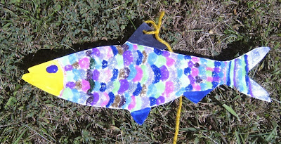
River herring decorated with glitter glue
Iridescent river herring created by Julia at the Cape Cod Wildlife Festival
Photo by Dorie Stolley 

What’s always fun for kids? Glitter glue! And, we had lots of it at the recent Cape Cod Wildlife Festival held at Mass Audubon’s Long Pasture Wildlife Sanctuary in Barnstable, MA. Kids listened to the story of mighty river herring battling their ways upstream, the obstacles they face and how people can help, as they decorated their own fish to take home. Creativity abounded, as did paint, glue and markers.

Big thanks go to Julia and Olivia, two girls who adopted our booth and assisted for hours, cutting out fish, encouraging children, keeping the tables clean and creating their own lovely herring.
Another river herring to join the school
Julia and her second herring
Photo by Heather Fone

Decorate-a-river-herring craft table
Olivia hard at work during a rare quiet moment at the booth
Photo by Heather Fone
 
Those who chose to keep their herring had a colorful souvenir of the day. The WAA website address was included on every fish so parents could visit it to learn about their local watershed, find simple ways to conserve water and locate fun water-related events all over southeastern Massachusetts.

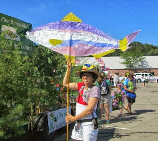
Some children left their herrings for WAA. These fish will join the ever-increasing river herring school that will “march” in the July 4th parade in Plymouth with the Plymouth Nature Brigade.
Colorful fish in July 4th parade
In 2014, there will be an entire school of herring to join the WAA mascot!
Photo by Lianna Lee

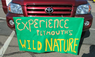
Banner on car in July 4th parade
Banner for the Plymouth Nature Brigade
Photo by Lianna Lee

 
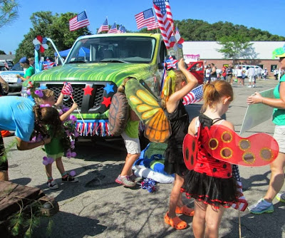
kids dress in costume for the July 4th parade
Monarch butterfly, blueberry bush, and ladybug joined the river 
herring in representing Plymouth's native wild animals and plants
in the July 4th parade. Join us in 2014?
Photo by Lianna Lee
The arts are used in many ways to stimulate environmental stewardship, conservation and activism. WAA’s decorate-a-herring activity promotes emotional connection to and aesthetic appreciation of native water-dependent wildlife and conveys information in a natural, storytelling fashion to children and their parents. It also promotes regional pride in an impressive fish with an evocative story whose future depends on the work of WAA, its member organizations and people who care about them and about clean water. For more information visit: www.watershedaction.org

Friday, September 20, 2013

Did You Know? How to Keep Your Watershed Healthy in Autumn

Autumn colors along the Taunton River by Bharani Padmanabhan, MD, PhD 
There is nothing like the glorious New England fall foliage reflected in the crystal clear waters of our ponds and streams. Let’s make sure we keep our water clean and plentiful this autumn. Here are some easy ways for you to help your watershed during this time of year. Reduce the amount of water you put on your lawn and garden. Stop fertilizing your lawn until the spring (or forever). Pump out your septic tank. Clean up your pet’s waste. Join your local watershed association (Find yours at: www.watershedaction.org).

These easy actions help combat three common autumn issues in watersheds--low stream flow, eutrophication and bacterial contamination--and help to keep our waters beautiful and unpolluted.

Low stream flow means there is too little water in a stream, which might go completely dry, stranding fish in ever diminishing pools of water. This is not a pretty sight nor healthy.

More frequently, water is still visible in a stream, however, levels drop so low that fish and other wildlife have trouble traveling and completing critical stages in their life cycles. For instance, due to little rain and use of water in the summer, streams can drop too low for young river herring, hatched upstream in the summer, to migrate downstream to the ocean where they will grow to adulthood.
Everyone can help by conserving water in the summer and early fall, such as by using sprinkler systems in the early morning or evening rather than during midday when the heat will cause much of the water to evaporate.

In fact, this is such a simple, feasible and successful idea that the towns of Hingham, Hull and Cohasset, served by Aquarion Water Company, implemented mandatory water restrictions in early July to protect their water supply before it became critically low. Residents could only use sprinklers or irrigation systems every other day and only before 10 a.m. or after 6 p.m. North and South Rivers Watershed Association estimated that this simple procedure saved 30,000 gallons of water per day. This assured that residents would have water all summer long and that streams wouldn’t run dry. A double winner.

Eutrophication is another issue at this time of year. It happens when a water body receives too many nutrients, which causes explosive plant growth. When the plants die they sink to the bottom of the water body where bacteria feed on them. This process uses up the oxygen that is dissolved in the water, which can lead to fish kills. The excess nutrients are often a result of human activities. For example, fertilizer from farm fields or lawns, sewage from faulty septic systems or leaky sewer pipes and pet waste can all contribute to nutrient overloading in water bodies.

Fortunately, there are some easy ways for everyone to help solve this problem. These include: decreasing fertilizer on lawns (or not using any), getting septic tanks inspected and pumped on a regular schedule (every three to five years is recommended), and picking up pet waste.

The third watershed issue in the late summer and early autumn is bacterial contamination. Many beaches are closed to swimming in the summer because of high bacteria counts, which can continue into the fall, often not noticed because monitoring stops, beaches close for the season and fewer people are swimming. Bacteria in the water can cause many undesirable problems including eye, ear and stomach infections.

There are two important ways to help solve this problem: getting your septic tank pumped out on a regular schedule and picking up pet waste. Sound familiar? These actions both reduce bacterial contamination and nutrient overloading.

For more ways to help your watershed all year long, visit: http://watershedaction.org/index.php/take-action/at-home.

Wednesday, August 28, 2013

Our visit to the Westport River watershed!


Today’s blogger is Shalen!

Just a stone’s throw away from Rhode Island, I visited the Westport River watershed in Westport, Massachusetts last week. Matt Patrick, the Executive Director of the Westport River Watershed Alliance (WRWA), led us around this spectacular area. Starting at the WRWA headquarters, I met Shelli Costa, the Education Director, and Gay Gillespie, who works in Development, and learned about the history and the present direction of the association.

Near the Westport Point
The WRWA was founded in 1967, after a group of concerned citizens came together to protest a proposed sewage lagoon in Westport. Since its establishment, the WRWA has nurtured its cooperative relationships with local businesses and government, residents, and its own members. The WRWA’s present focus is three-pronged: advocacy before state and local boards for the preservation of the watershed’s resources, education, and water quality monitoring. The WRWA has a significant influence on development and conservation projects in the area and staff and members attend Board of Health and other state and local meetings. Education is a big part of this organization’s mission, too, with summer camps and programs and school-based modules are among its successes. WRWA’s water quality testing program is one of the oldest continuously operating ones in the state.

The Westport River watershed is 100 square miles in size and includes parts of Massachusetts (Westport, Fall River, Dartmouth, and Freetown) as well as Rhode Island (Tiverton and Little Compton). About 85% of the watershed’s land mass drains into the East and West Branches of the Westport River, which empty into Rhode Island Sound. The remaining 15% drains into Fall River’s Mount Hope Bay. Because of its proximity to the ocean, the watershed is largely estuarial, an important saltwater habitat for shellfish and eelgrass. This watershed is one of the healthiest estuary systems in Massachusetts, because of its sparse development and low population.

To begin our tour of the watershed, we drove south from the WRWA headquarters to Westport Point and got a taste of the unbridled beauty the Westport River’s waters have to offer. From there we drove over Route 88 and down the west side of the east branch of the river to Baby Beach where the WRWA runs educational programs for children. For instance, fifth graders learn about dune ecosystems and plant beachgrass every October as part of the Watershed Educational Program (WEP), which reaches about 2,000 students in Westport schools every year and complements the schools’ science curricula. The program fosters a sense of stewardship at a young age. Each year the students learn about topic-specific watershed issues, such as the watershed drainage model (used to discuss the importance of rain gardens for stormwater runoff), and work on solving watershed challenges that impact their community, like coastal erosion.

When we arrived at Baby Beach, we found Shelli Costa, known as “Heron” to the kids, and two summer interns from UMASS Dartmouth, nicknamed “Periwinkle” and “Egret,” running a program attended by neighborhood children. The willing students began their exploration into marine ecosystems by learning about the life cycle of the Atlantic silverside and making colorful fish mobiles to take home. Following that, Shelli led them over to the water to search the shallow waters for signs of life while Periwinkle and Egret waded into deeper water to net organisms for the kids to inspect. The children were excited to see silverside fish, spider crabs (we even watched one molt its shell!), jellyfish, and one oddity, a tropical fish, which wandered in from the Gulf Stream, whose currents shift more close to shore in the summer. The kids were eager to share anything they knew about the fish they found, and I could tell they were having a great time. To see children excited about environmental education at so young an age and feeling so passionate about the watershed is refreshing. These children, as so many in the Westport school system who have been exposed to WRWA programs, recognize how integrated their lives are with their environment.

A portion of the constructed wetland the WRWA maintains.
Departing reluctantly from the excitement of the program at Baby Beach, we headed south and east to Horseneck Beach and East Beach, then, traveled north up the eastern side of the east branch of the Westport River. We visited Allens Pond, a tidal pond and wildlife sanctuary run by Mass Audubon. Our panorama of the pond and the coastal beaches was positively breathtaking.

During the course of our travels, we visited the Head of Westport, one of the three villages in Westport and the location of an historic building that may become the future office of WRWA. Behind the building and next to Osprey Sea Kayak Adventures is a constructed wetland that the WRWA designed, built, and now maintains. Its purpose is to filter pollutants from diverted stormwater runoff before allowing the water to enter the river—an engineered, yet natural-appearing solution to a common problem (stormwater runoff) that affects water quality.

Just up the street from the wetland is Westport Middle School, where we watched city workers construct a rain garden at the front of the school. Another freshly planted rain garden sits around the side of the school. The WRWA’s partnership and cooperation with the city of Westport is evident in these gardens. It’s also a good example of WRWA’s influence in conservation projects and maintenance of open space and clean water throughout the area.

We drove next to the Hix Bridge. Huge granite blocks discarded in the Westport River during the bridge’s reconstruction clog the channels, slowing the water current and promoting the deposition of sediment causing difficulties for the native oysters. WRWA is working with a former EPA employee, Ken Perez, to study the negative effects of this sediment buildup on oyster health. The WRWA works with the town (much like the Neponset River Watershed Association does), rather than against it on issues such as this. Environmental organizations’ cooperation with their local people and governments fosters positive and cooperative relations and expedites progress.

The Fork in the Road!
We wandered via the scenic route close to the river’s shores until we crossed Cornell Road and drove down the west branch of the river near Adamsville, where we saw the “fork in the road,” a literal fork statue at the intersection of River Road and Old Harbor Road. Sculptor Tom Schmitt created it in 2010 for a WRWA fundraiser. We then passed a pond near Grey’s Grist Mill that WRWA helped dredge. We briefly crossed the Rhode Island state line in our travels.
Westport Herring Run

Our final stop was the Westport herring run, just across the river from Westport Point, the first stop in our tour. In the spring, river herring swim upstream into Cockeast Pond. This is another truly unforgettable spot in the watershed. I’ve learned it’s crucial to have a view of the river, either for recreational purposes or emotional restoration, because if people can see the river, they will be more likely to have a concrete and personal attachment to its protection.


To see with my own eyes and experience these watershed areas first-hand, demonstrates to me their valuable ecological and emotionally restorative characteristics. Each watershed environment is priceless, unique, and passionately protected by those who care for it and call it home. To become a member of the Westport River Watershed Alliance, and to learn about the WRWA’s stormwater projects, volunteer opportunities, dune restoration project and more, visit http://westportwatershed.org/.

Monday, July 15, 2013

Welcome to WAA, Herring Ponds Watershed Association!

Today’s blogger is Shalen!

Little Herring Pond public access point
Lee Pulis, of the Herring Ponds Watershed Association which was founded in 2007 as a volunteer neighborhood organization, was kind enough to take us on a tour of the Herring Ponds watershed last Thursday! The HPWA is WAA's newest member! This watershed is not a hydrologic watershed but a state-d
esignated area of critical environmental concern (ACEC), with politically designated boundaries (one of which is Rt. 3). The ACEC is an important area for recreation as well as for water supply, as most of its residents draw from the Plymouth-Carver Aquifer. In addition to sampling pond water and storm water runoff, the HPWA commits to educating residents about their watershed and promoting boating and recreational safety.

The highlights of this watershed are the Little and Great Herring Ponds. Little Herring Pond (I will use the abbreviation LHP for brevity) is at maximum 5 feet deep. Its northern waters never freeze, so aquatic plants abound and it is a great fish pond. Motor boats are not allowed on LHP, and because of this there are no invasive species which often spread by boats and their trailers.

Great Herring Pond (GHP), however is much larger: its waters span 376 acres and are at least 20 feet deep. It receives 80% of its water from the LHP. The state requires a 100-foot buffer zone for any construction around its shores, because of its designation as one of the great Massachusetts ponds. Of course there are many grandfathered homes all around the shoreline, so buffer zone stewardship education is a prime mission of HPWA. Carter’s River flows downstream from LHP to GHP.

At the Carter Beal Conservation Area
Our first stop in this watershed was the Ponds of Plymouth housing development on the western edge of LHP. We saw lots of large expanses of irrigated lawn with non-native decorative plants. Just off one of the development’s roads is Pickerel Pond, part of The Wildlands Trust.

Water recreation is an important attraction in the Herring Ponds watershed. This watershed not only boasts residential properties along the shores of both ponds, but also many parks and day camp areas for adults and kids alike. Two such properties are Camp Clark and Hedges Pond Recreational Area. The former is a YMCA day camp for kids, has horses, nature trails, and offers swimming in Hyles Pond. The latter is a recreation area open to the public on afternoons and weekends, and which used to be an church nature camp.

After a quick interlude, in which we allowed a portion of the pouring rain to pass, we headed south along LHP’s western shores and encountered considerable runoff from the rain heading into Carter’s River, the water body connecting the two main ponds.

We drove past Parcel 15, an area of inactive cranberry bogs, between LHP and GHP. The town missed the deadline of exercising first right of refusal to buy it, and there’s a battle as to whether this land will be reactivated and two more houses with septic systems will be built on the land nearby.The Plymouth Community Preservation Community has since met and indicated it has the funds and will encourage Selectmen to correct the mistake and preserve this area to protect area water quality and recreation. Keep an eye out for further updates.

From thereon we ventured to the LHP public access point, which leads to the northeast part of GHP, and at which was a flow gauge. The wooded path leading to this outlet was rife with horrid construction materials and used electronics dumping. A short distance away, I saw a rain garden for the first time (see right), near the shores of GHP, constructed as the surface part of an underground stormwater filtration system.

Further down GHP’s southwestern shores sits a Massachusetts Maritime Academy sailing facility, offering rowing and sailing lessons, among other recreational activities. This facility is also one of the few places in the world you can learn to drive an oil tanker by training on a 1/12th working scale model. Pretty cool!

We next observed a few passing locations including a Native American burial ground, another flow gauge towards the end of the Herring River, a boat launch in Bourne, and the Carter Beal Conservation Area, which included a fish ladder.

We reached the Herring River’s outlet by late afternoon: it flows into Cape Cod Canal, and it is at this location that herring swim up the river near the Herring Run Recreation Center. This center provides people with a view of the river (and sometimes herring!), information regarding the contribution of herring to the watershed, the Sagamore Bridge, and a recreation road dedicated purely to biking and pedestrian activities, much like the Neponset River Trail that I visited several weeks ago. This trip was a refreshing and amazing one, one during which I learned how watershed recreation creates an active community among an area’s residents!

Want to learn more about the Herring Ponds Watershed Association or volunteer in any of their activities? Visit their website http://www.theherringpondswatershed.org/Home_Page.php and check out their landmark stewardship guide at http://www.theherringpondswatershed.org/uploads/HPWA_Stewardship_Guide.pdf.

See the following link to learn more about the Lower Neponset River Trail: http://bostonharborwalk.com/placestogo/location.php?nid=2&sid=63

Wednesday, July 3, 2013

Kayaking on the North River!

Today’s Blogger is Shalen Lowell!

I’m always diving into new things, so last week I went kayaking for the first time! As part of the 2013 Wampanoag Paddle Fundraiser, Dorie and I paddled the 12.5 mile first leg of the Wampanoag canoe passage to experience first-hand the North and South Rivers watershed.

This watershed comprises 12 towns including Norwell, Scituate, Hingham, Hanover, Pembroke, and Weymouth, is an expansive watershed, and was known for shipbuilding. Used as channels for melt water when the glacier moved north around 10,000 years ago, the North and South Rivers surround 3,000 acres of salt marsh and 2,000 acres of endangered species habitat. The North River rises the from marshes and springs in Weymouth, Rockland and Hanson, emptying into the Atlantic, and the South River’s source is Round Pond in Duxbury.

The watershed’s topography is dynamic: for instance, as the rivers deposited silt, the salt marshes extended, keeping up with the sea level rise. The watershed lowlands contain fresh and salt water marshes, crucial for stormwater runoff and habitats for local wildlife, whereas a small section for the uplands is used for agriculture.

The NSRWA is working on Third Herring Brook, a tributary of the North River. As of now, herring can only access the bottom part of the watershed system, and have trouble moving upstream. There is only a 26% passage outflow in the fall. The Third Herring Brook has four dams that traverse its main stem. The NSRWA is working to take out one dam, funded by the YMCA, which is hesitant to go through with the dam destruction because of a lack of funds.


Peter Kelly-Detwiler and Nik Tyack once again paddled the 72-mile long passage mentioned above to raise money for the North and South Rivers Watershed Association. In a statement about their fundraiser, Peter and Nik said, “We hope to both raise awareness of Massachusetts' beautiful rivers and also support the North and South Rivers Watershed Association in their pioneering efforts to preserve and restore the watershed we grew up in. Recent successes of the organization include bringing river herring back to Scituate's First Herring Brook and re-opening shellfish beds on the South River.”

We kayaked down Herring River from the Driftway Park in Scituate, to where the Herring meets the North in proximity to the ocean. We then entered up the North River. I traveled with Dorie half the time, and the other half by myself; as a writer some reflection time suits me well.  Upon reflection, the journey seems a blur of riverside docks and waterfront properties, sprawling forests, and tall grasses. I do, however, remember feeling exhilaration as I swept down the river and jetted right under a highway overpass. Nothing pumps me up like the adrenaline of emerging under a bridge and into the open for a new adventure. I tired quickly by the end of my journey and my arms ached the entire day after! The repercussions were well-worth the experience though.

This journey was a unique one. So far, I’ve been viewing the southeastern MA watersheds and their main waterways from their shores, looking at the rivers. But instead of touring the watershed land, we were actually on the water, where I was able to gain a different perspective. We literally traversed the land as if we, too, were the North River.

This perspective led to an overwhelming contemplation about the North River: I thought about just this one river, and the countless ecosystems it encompasses, which broadened to the North and South Rivers watershed, to the millions of waterways in this country and in the world, the minute and fragile, interlocking environments. Each environment is its own, and also connects to all others; each one is vital to its environment and to the lives of organisms around the world. I also imagined what it was like for the Wampanoag Native Americans to have to traverse the waters, how taxing, frustrating, and rewarding it must have been.

Thanks to this experience, I’ve found that kayaking is something I could see myself doing long-term. A big shout out to the NSRWA for sponsoring this fun and successful event and for their ongoing work on ecosystem restoration in the watershed! If you want to learn more about the North and South Rivers watershed or NSRWA’s advocacy, history, and volunteer opportunities, visit http://www.nsrwa.org/ or log onto http://watershedaction.org/.

Monday, June 24, 2013

Next Stop, the Jones River watershed!

Our Blogger today is Shalen Lowell

Elm Street Dam, Kingston MA
A few weeks ago I had the pleasure of visiting the Jones River Watershed Association (JRWA) and the unique and beautiful Jones River watershed. This watershed is relatively small, and is self-contained in the town of Kingston. It begins upstream at Silver Lake and flows down and out to Kingston Bay. Although this watershed occupies a relatively small geographic area, it contains a multitude of unique ecological features such as coastal areas, cranberry bogs, and a glacial lake.

Led by JRWA intern Amy Meloski, we first stopped at Kingston Bay, to which the Jones River flows, as it winds through the watershed from Silver Lake. We journeyed upstream from the bay to Mulliken’s Landing, a canoe launch leading out to the Jones that was overgrown and out of care. The landing’s path was shrouded with overgrown bushes and vandalized benches. Should someone take up this project, the Landing would be a great recreational attraction for this downstream section of the watershed.

On our tour upstream, we encountered a road block at the Elm Street dam: the bridge there is under construction. There we saw the fish ladder which enables herring to traverse the dam and with which the JRWA observes herring counts. Though many herring pass along the river in this manner, smelt and shad are unable to get through. Like many of us, the JRWA is concerned with herring runs, which is an indicator of overall watershed health. Because herring counts are so crucial at the Elm St. dam, during April and May, the JRWA allows volunteers to assist with the herring counts, a great way to engage the public, to take ownership, and to get people involved in their local environment.

A refreshing walk along a wooded path led us to several more fish ladders which led up to a pond on higher ground. The fish ladders pass from the pond, down to the Jones River, bridging an earthen dam.

The last spot I saw was the glacial Silver Lake (see right). The lake provides drinking water for the town of Brockton and its water is pumped out to Brockton every day. This restricts river flow from the lake, and in times of low-flow or draught, can be cut off from the flow of the Jones almost entirely.

The JRWA’s primary concern is removing dams in the Jones River watershed, and eventually getting the fish back to Silver Lake. Many earthen dams in the area are coming to the end of their lives and must be disposed of instead of repaired. Dams are more expensive in the long run due to the initial costs of construction but also lifetime maintenance. Here I learned that a river is better left to flow naturally rather than be subjected to unneeded construction.

The JRWA dismantled one such dam not long ago: the Wapping Road dam which is one of the inactive, concrete dams abandoned after industrial development.

Possibly the JRWA’s most important investment is in environmental education. Not only does the association visit schools, but it also encourages student volunteering. Pine duBois is working with high school students to use one of the bog areas that still remains in the Three Rivers Basin to set up a sustainable business, selling and maintaining the cranberries in this area. The majority of the Three Rivers Basin, 29 acres previously used for cranberry bogs, is being restored to the habitats that used to occupy the Jones River along Pine Brook.

To visit the Jones River Landing’s website and learn more about the Jones River Watershed Association, please visit http://jonesriver.org/ or WAA’s site at http://watershedaction.org/

Friday, May 31, 2013

Herring Once Swam Up Mansfield's Rivers

Our Guest Blogger is: By Harry B. Chase, Jr., lifelong Mansfield resident who served on the town’s first conservation commission and is a founding and charter member of the Natural Resources Trust of Mansfield.
 
Posted May 27, 2013 @ 12:59 PM
 
Henry B Chase Jr WAA
It’s hard to believe that uncounted numbers of herring once swam from the Atlantic into Narragansett Bay and Taunton River and thence up Mansfield’s Wading, Rumford and Canoe rivers to spawn.
Each spring, where the salt tide met the outpouring of fresh river water, herring gathered in vast schools. By some unfathomable intuition they knew in which river they were born, and up that stream they made their way.

The early colonists learned that the herring run, as they called it, usually reached Taunton the first week in April. From there for miles upstream, men with nets crowded at favorite spots to capture their fish dinners.

The myriads of herring that eluded the nets continued their journey. The female, when she came to a warm, shallow pond, laid up to 100,000 eggs and the male fertilized them. Less than 1 percent of the eggs survived.

To learn who first profited from the herring harvest we have to go back 9,000 years, to when the Indians arrived. These early people were hunter-gatherers, nomads who erected temporary camps wherever they found food.

They trapped herring in weirs made of willow sticks driven in the shallow streambeds. Near Rumford River in Mansfield’s South End, 20th century archeologists found a flat rock ledge where the Indians sun-dried their catch for food.

The Quahannock Wampanoag, who came several thousand years later, settled in villages and grew corn, beans, pumpkins and squash. Every spring their men and women gathered along the streams and caught herring by the basketful.

Sometimes the Indians ate herring mixed with tastier fish, but most of the catch they carried to their corn fields and used for fertilizer. Their word “munwharwhateag” could mean either “small fish” or “manure.”

We learned in school how the Indian Squanto taught the Pilgrims to lay two or three herring in the ground and cover them with soil in which they planted corn kernels.
Later settlers kept their dogs tied for three or four weeks until the fish rotted, otherwise the canines would dig the corn hills up.

When white men built Taunton’s first water-powered gristmill in 1650 the town fathers ordered them to construct a gently sloping wooden fish ladder so the herring could bypass the dam and swim upstream as they’d done for thousands of years.

People were amazed to see the plucky foot-long fish fight their way up the ladder against the strong force of the river water.

In 1711, after Norton (which included future Mansfield) split from Taunton, the town chose wardens to enforce the ladder law.

When Mansfield in turn divided from Norton in 1770, voters appointed David Grover and Josiah Pining fish wardens for one-year terms. They were followed by Lieut. Job Hodges and Reuben Titus, and then Ephraim and Jonathan White.

Fishermen would gather in great numbers at our herring runs. House-to-house peddlers knocked on doors hoping to sell strings of herring they carried on long sticks.

The first local obstacle to the passage of fish dated from 1695 when John Wilkinson, to obtain waterpower for his gristmill, dammed Rumford River at Willow Street.

In 1740 Col. Isaac White built a sawmill on the Rumford near South Main Street. His dam was the first on that stream north of Taunton.

The earliest dam on East Mansfield’s Canoe River was erected for the Leonard iron works before 1728. Wading River in West Mansfield got its first dams in 1815.

I’ve seen no record that fish ladders were provided at these obstructions, which probably spelled the end of Mansfield’s herring run.

Even today, people gather at well-known spots in Middleboro and Lakeville, where every spring two-thirds of a million herring come up Nemasket River.

But so many dams were built between Taunton and Mansfield that after about 1800 herring no longer swam upstream to spawn in this old town.

* * *

Lifelong Mansfield resident Harry B. Chase Jr. served on the town’s first conservation commission and is a founding and charter member of the Natural Resources Trust of Mansfield. He can be reached at mansfield@wickedlocal.com

Read more: THIS OLD TOWN: Herring swam up Mansfield’s rivers - Norton, MA - Norton Mirror http://www.wickedlocal.com/norton/topstories/x514111273/THIS-OLD-TOWN-Herring-swam-up-Mansfield-s-rivers#ixzz2UrwEIqJK
Follow us: @WickedLocal on Twitter | 119311408344 on Facebook